
Conversations about geology with researchers making key contributions to our understanding of the Earth and the Solar System
What moves the continents, creates mountains, swallows up the sea floor, makes volcanoes erupt, triggers earthquakes, and imprints ancient climates into the rocks? Oliver Strimpel, a former astrophysicist and museum director, asks leading researchers to divulge what they have discovered and how they did it.
~ ~ ~ ~ ~ ~ ~ ~ ~ ~ ~
Geology Bites currently has 87 episodes, each about 30 minutes long. You can use the index to browse by topic.
If you’d like to be notified when a new episode comes out, you can set that up on the Contact page.
~~~ New Episode April 10, 2024 ~~~
Richard Ernst on Large Igneous Provinces

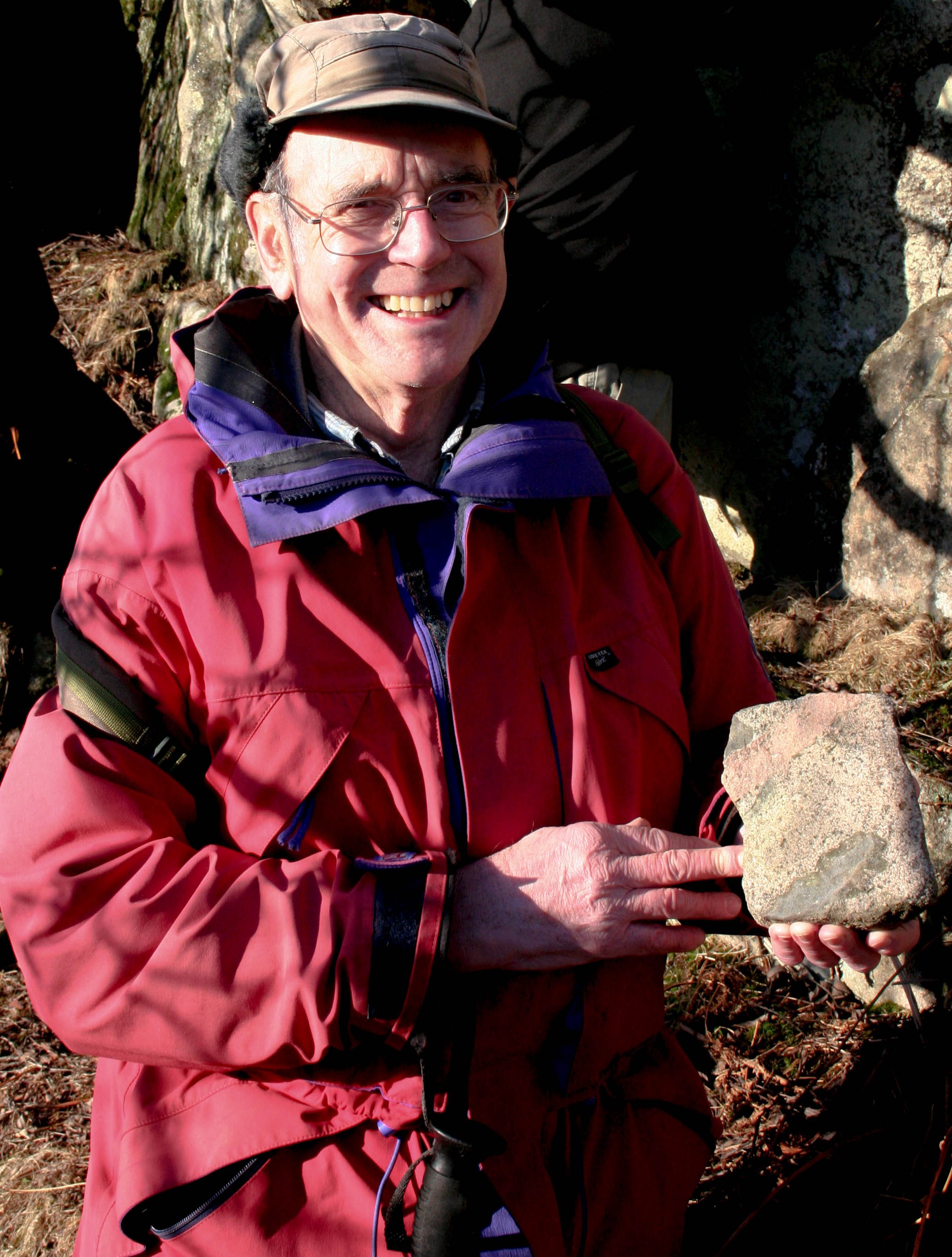
At 15-25-million-year intervals since the Archean, huge volumes of lava have spewed onto the Earth’s surface. These form the large igneous provinces, which are called flood basalts when they occur on continents. As Richard Ernst explains in the podcast, the eruption of a large igneous province can initiate the rifting of continents, disrupt the environment enough to cause a mass extinction, and promote mineralization that produces valuable mineral resources.
In the image, Ernst is pointing out the contact between a 1.3-billion-year-old dolerite sill (above) that formed part of the plumbing of a large igneous province and the host black shale in northern China.

Perhaps as many as five times over the course of Earth history, most of the continents gathered together to form a supercontinent. The supercontinents lasted on the order of a hundred million years before breaking apart and dispersing the continents. For decades, we theorized that this cycle of amalgamation and breakup was caused by near-surface tectonic processes such as subduction that swallowed the oceans between the continents and upper mantle convection that triggered the rifting that split the supercontinents apart. As Damian Nance explains in the podcast, newly acquired evidence suggests a very different picture in which the supercontinent cycle is the surface manifestation of a process that involves the entire mantle all the way to the core-mantle boundary.

The Earth’s tectonic plates float on top of the ductile portion of the Earth’s mantle called the asthenosphere. The properties of the asthenosphere, in particular its viscosity, are thought to play a key role in determining how plates move and subduct, and how melt is produced and accumulates. We would like to know what the viscosity of the asthenosphere is, and how it depends on temperature, pressure, and the proportion of melt and water it contains. Few mantle rocks ever reach the Earth’s surface, and those that do are altered by weathering. So, as he explains in the podcast, David Kohlstedt and his team have tried to replicate the rock compositions and physical conditions of the mantle in the lab. Using specially-built apparatus such as the one shown in the picture, he has been able to determine the viscosity of the asthenosphere to within an order of magnitude, which is an enormous improvement on what was known before.
Photo courtesy of Sally Gregory Kohlstedt

In many countries, nuclear power is a significant part of the energy mix being planned as part of the drive to achieve net-zero greenhouse gas emissions. This means that we will be producing a lot more radioactive waste, some of it with half-lives that approach geological timescales, which are orders of magnitude greater than timescales associated with human civilizations. In the podcast, Claire Corkhill describes the kind of geological storage being planned to keep such waste safe. Here she is using a synchrotron beam at Brookhaven National Laboratory to measure corrosion layers at the surface of glass.

Our ideas about the geological history of the Moon have changed radically over the past few years owing to new results from analysis of lunar samples returned to Earth by Apollo 17 and Chang’e 5, as well as detailed remote sensing from orbiters. As Mahesh Anand discusses in the podcast, these results have in turn thrown up new questions about the nature and timing of lunar volcanism. And as we prepare to support a long-term human habitation on the Moon, we need to learn about the presence of water and other useful resources on the lunar surface. Anand argues that the return of astronauts to the Moon will greatly accelerate research on understanding the geology and habitability of the Moon and other nearby bodies in the Solar System.
Photo courtesy of the Open University
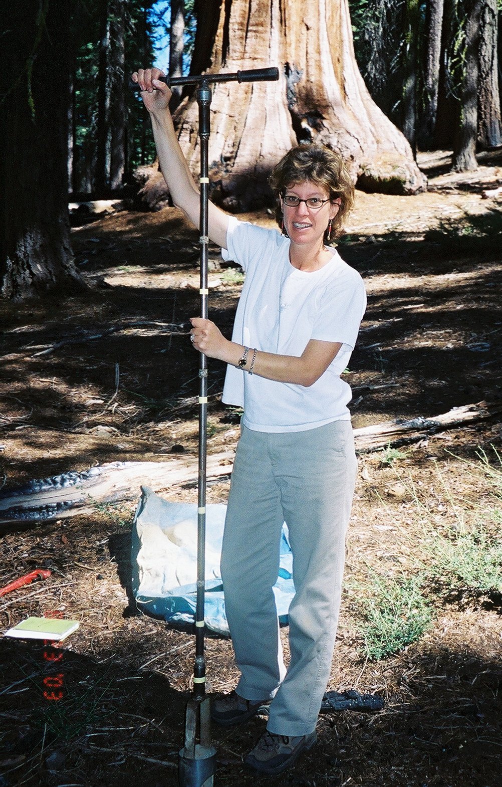
The remarkable stability of the Earth’s surface temperature over billions of years is thought to result from a balance between the injection of greenhouse gases into the atmosphere by volcanos and the removal of such gases by the weathering of rocks in the presence of water. To help understand how this operates as a negative feedback mechanism, Susan Brantley has performed detailed studies of the weathering reactions of silicate minerals in the lab to understand what controls the rate of such reactions. As discussed in the podcast, she has recently analyzed how such reactions work in the field in different climatic and geomorphological contexts and on various spatial scales up to the global scale.
In the photo, Brantley is preparing to augur a soil in Yosemite National Park to determine mineral abundance as a function of depth and relate it to the rate of weathering.

In the early Proterozoic, about 2.5 billion years ago, enormous thicknesses of iron-rich rocks were deposited on continental shelves. Striking cliffs of these rocks form the walls of many canyons in Western Australia and South Africa. They are called the banded iron formations (BIFs) because they show vivid banding between the reddest, most iron-rich layers and ochre-colored layers containing siliceous material such as chert. What is the origin of the BIFs? For many years, the prevailing theory was that large amounts of dissolved iron were present in the early oceans, and it was the oxygen from the first oxygen-producing life forms in the water that oxidized this iron into an insoluble form, which then precipitated out of the oceans to form the BIFs. In the podcast, Clark Johnson explains how biological processes may have been responsible for oxidation of iron in seawater under oxic or anoxic conditions, as well as later reduction as the BIF sediments compacted on the seafloor.

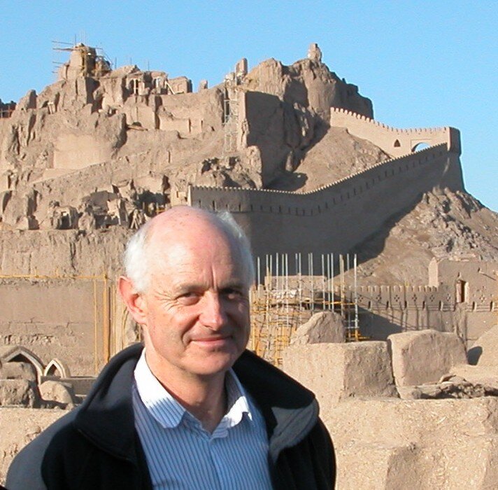
The geological history of most regions is shaped by a whole range of processes that occur at temperatures ranging from above 800°C to as low as 100°C. The timing of events occurring over a particular temperature range can be recorded by a mineral that crystallizes over that range. The mineral calcite is suitable for recording low-temperature processes such as fossilization, sedimentation, and fluid flow, and it is especially useful as it is virtually ubiquitous. But using uranium-lead radiometric dating in calcite is very challenging as it often contains very little uranium, and the ragiogenically-produced lead isotopes can be swamped by common lead within a calcite crystal. In the podcast, Catherine Mottram explains how these challenges are being overcome and shares some of her findings based on radiometric dating of calcite.
Photo: University of Portsmouth, Sam Shaw

Stromatolites are the layered structures left behind by microbial communities. They are the fossil evidence for far and away the earliest life on Earth. But the interpretation of the very earliest stromatolite-like structures as being biogenic in origin is controversial. Martin Van Kranendonk tells the story of the discovery of almost pristine stromatolites in 3.48-billion-year rocks of the Pilbara of Western Australia. By meticulous study of their structure, relationship to their geological environment, and chemical and isotopic composition, he establishes a convincing case for life on Earth going back at least as far as the age of these Pilbara rocks.
In the image, Martin Van Kranendonk is on one of the main stromatolite outcrops in the Pilbara , looking down on the tops of multiple cone-shaped stromatolites of the 3.4 Ga Strelley Pool Formation, only slightly younger than the 3.48 Ga Dresser Formation.

The Alps are a relatively young mountain range, having started to grow only about 25 million years ago. But, as Rob Butler explains in the podcast, for the Western Alps, this growth was preceded by 15 million years of subduction of the greatly thinned continental crust that once formed the margin of Europe. Subduction was choked off by the arrival of crust that had experienced rather little pre-alpine rifting. The diversity of structures seen on mountainsides and the styles of crustal deformation (thrust faulting and distributed strain) can be related to the variations in the structure of the European margin at that time. In this way, the Alps, and most other collision mountain belts, can be viewed as amplifications of pre-existing geological heterogeneities – and detecting these heterogeneities, recorded in the stratigraphy of rocks deposited before mountain building began, is a key to tectonic understanding.

The Franciscan Complex is a large accretionary prism that has been accreted onto the western margin of the North American continent. Unlike most such prisms, which are submarine, it is exposed on land, making it a magnet for researchers such as John Wakabayashi. In the podcast, he describes this remarkable complex and explains the mechanisms that may have operated over its 150-million-year history.

When we look at sedimentary rocks, we are seeing the accumulation of material that has been preserved. But if we use the sedimentary record to make inferences about the past, we need to understand how what we see today is filtered by preservational bias. As Bruce Levell describes in the podcast, it can be difficult, or even impossible, to infer what is missing, or indeed whether anything is missing at all.

In a recent episode, Nadja Drabon spoke about newly discovered zircon crystals from the late Hadean and early Archean. The zircons revealed information about processes occurring in the Earth’s nascent crust, casting light on when and how modern-day plate tectonics may have started. In this episode, we talk about a very different source of information about the early Earth, namely the abundances of noble gases occurring within present-day basalts. It turns out that these can probe the Earth’s mantle and atmosphere even further back in time – to the first 100 million years of Earth history.
Sujoy Mukhopadhyay leads a team of researchers who have developed new techniques for measuring the abundances of noble gas isotopes in a variety of Earth materials. He used his results to identify mantle reservoirs that formed during the first 100 million years of Earth history and, amazingly, survive to the present day.

In 2011, a massive earthquake struck off the eastern coast of Japan. The destructive power of the earthquake was amplified by a giant tsunami that swept ashore, killing over 15,000 people. A major cause of the tsunami was the 50-m slip along the plate boundary fault between the subducting Pacific plate and the overriding North American plate. Patrick Fulton and his team set out to find out why there was so much movement along the fault by installing a temperature observatory in a borehole drilled right through the fault zone.

The devastating earthquakes that struck near Turkey’s border with Syria on February 6, 2023, killed over 50,000 people. One reason for this appalling loss of life was the occurrence of a second major earthquake just 10 hours after the first one, while rescue efforts were under way. How might an earthquake trigger delayed slip on a different fault? Romain Jolivet uses radar satellite data to pin down how plate boundaries deform between and during earthquakes. This casts light on the mechanisms that relate slow and rapid slip along the major bounding faults of tectonic plates.

The geological record shows that the Earth’s carbon cycle suffered over 30 major disruptions during the Phanerozoic. Some of the biggest ones were accompanied by mass extinctions. Dan Rothman analyzed these disruptions to find a pattern governing their magnitude and duration. As he explains in the podcast, this pattern is suggestive of a non-linear dynamical system that, once excited, undergoes a large excursion before returning to where it was. Could we be exciting such a disruption now?
Courtesy of Helen Hill

Vanishingly few traces of the early Earth are known, so when a new source of zircon crystals of Hadean age is discovered, it makes a big difference to what we can infer about that eon. In the podcast, Nadja Drabon describes how she analyzed the new zircons she and her colleagues discovered and what they reveal about the Earth’s crust between about 4 and 3.6 billion years ago.
Nadja Drabon in the Green Sandstone Bed in South Africa

Over the course of Earth history, many parts of the crust have undergone multiple episodes of metamorphism. Modern methods of dating and measuring trace-element abundances are now able to tease out the timing and conditions of the individual episodes. But new techniques were needed before these methods could be scaled up to unravel regional tectonic events such as the formation of mountain belts and subduction zones and continental rifting. In the podcast, John Cottle describes one such technique that he and his group developed that has radically changed the scope of metamorphic rock studies.
John Cottle examining a sheared coarse-grained granitoid near the Byrd Glacier in Antarctica, courtesy of Graham Hagen-Peter

Rivers can seem very ephemeral, often changing course or drying up entirely. Yet some rivers have persisted for tens or even hundreds of millions of years, even testifying to the breakup of Pangea, the most recent supercontinent, about 200 million years ago. In the podcast, Martin Gibling talks about rivers old and new, and how they are affected by tectonic processes over tens of millions of years, as well as by human activities over a few thousand years.

This episode is a bit of a departure from the objective approach to geology of past episodes in that here we address the subjective nature of various rocks as experienced by a rock climber with a literary bent.
A rock climber’s very survival can depend on the properties of a rock encountered along a climbing route. This engenders a uniquely intense relationship between climber and rock. Anna Fleming has written perceptively about this intense relationship gained from climbing in Britain and the Mediterranean. In a book entitled Time on Rock, she writes about her experiences climbing gritstone in England’s Peak District, gabbro and granite on the Isle of Skye, sandstone on the northeast coast of Scotland, and limestone cliffs on the Greek island of Kalymnos, among others.
Courtesy of Murdo MacLeod
Between 1.3 and 1.1 billion years ago, magma from the Earth's mantle intruded into a continent during the assembly of the supercontinent called Nuna. Through good fortune, the dykes and central complexes that resulted have been preserved in near-pristine condition in what is now the south of Greenland. The dykes are extraordinarily thick, and the central complexes contain an order of magnitude more exotic minerals than otherwise similar complexes around the world. In the podcast, Brian Upton describes what he found during over 20 seasons of field work there and explains how extreme fractionation of the magma might be responsible for the one-of-a-kind central complexes.

Slabs of oceanic lithosphere dive into the mantle at subduction zones. Within the slab there is water — both water that seeps into the rocks through faults, and water within the crystal structure of certain minerals. Where does this water end up? In the podcast, Geoff Abers explains how we can probe the subduction zone with seismic waves to answer this question. The results are surprising — over geological time, the amount of water in all of today’s oceans may have been mixed into the deep mantle by subducting plates.

Popular reconstructions of ancient environments, whether they be in natural history museum dioramas, movies, or books, present a world of color. But are those colors just fanciful renderings, perhaps based on the colors we see around us today? Or is there evidence in the fossil record that we can use to determine the actual color of plants and animals that lived in the geological past? In the podcast, Maria McNamara explains that such evidence is indeed present in certain exceptionally well-preserved fossils. And she describes how she is using it to reveal the vivid colors of insects and vertebrates that lived in the geological past.

As it becomes increasingly unlikely that human greenhouse gas emissions will slow rapidly enough to avoid serious climate change, mitigation efforts are growing in importance. A promising approach to mitigation is the removal of carbon dioxide from the atmosphere. Phil Renforth is developing the science and practice of large-scale carbon dioxide removal using geochemical methods. In the podcast, he describes several such methods, focusing on enhanced weathering of rocks and industrial waste, and the liming of the oceans.
In the image, he is using a borehole to sample slag, which is one of our most voluminous industrial waste materials.

Although to a first approximation, tectonic plates move like rigid caps over the asthenosphere, they are not, in fact, totally rigid. They flex in response to loads placed upon them at plate interiors and stresses that impinge upon them at their margins. Tony Watts uses the observed flexure of oceanic plates in response to loading by seamounts to determine how strong the plate is below the seamount. He discovered that less than half of the plate’s thickness supplies the elastic strength that supports the seamounts. The rest is brittle (top layer) or ductile on the relevant timescales (bottom layer).

Life only emerged from water in the Ordovician. By that time, life had been thriving in oceans and lakes for billions of years. What did the colonization of the land look like, and how did it reshape the Earth’s surface? Neil Davies describes how we can decipher the stratigraphic sedimentary record to address these questions. Perhaps surprisingly, it’s easier to recognize small and fleeting events than to recognize large-scale features such as mountains, valleys, and floodplains. He also describes his remarkable 2018 discovery of the largest known arthropod in Earth history — a 2.6-meter-long millipede.

To unravel the early history of the solar system, we need to look beyond the Earth, since any evidence of such a distant past has been thoroughly erased by the Earth’s active geological processes. Asteroids, and the meteorites they spawn, have been useful in this regard, as they are thought to be unaltered scraps left over from the earliest stages of planet formation. In this episode, we focus on a very special asteroid called Psyche that will be visited by a spacecraft to be launched in August 2022. Ben Weiss explains why we want to know how it formed, not only to understand Psyche’s history, but also because it will shed light on the history and structure of the inner planets of the Solar System. It may also help us understand some of the dense bodies we’re rapidly discovering around other stars.

As the Indian Plate grinds inexorably northwards into Tibet, its movement is accommodated, in part, by large earthquakes. Many faults showing evidence of past earthquakes run along the Himalaya, but it is the Main Frontal Thrust that is currently the most active. The surface expression of this fault runs along the foot of the Himalaya in northern India. To the north, the fault plunges below the Himalaya and Tibet. As Roger Bilham explains in the podcast, we now have evidence of a zone of partial seismic coupling along the fault plane at intermediate depths. This can store hidden reservoirs of elastic energy that can be released during an earthquake, amplifying it into one of the devastating megaquakes that can wreak so much damage.
In the image, Roger Bilham is excavating beneath temple blocks thrown from the wall of an 8th century temple in Kashmir by an earthquake in 1123. The blocks have been undisturbed since they fell, trapping soil beneath them. Using carbon 14 dating of charcoal in the soil, he was able to date the earthquake.
The fossil record of complex life goes back far beyond the Cambrian explosion, to as far back as 1,600 million years ago in the late Paleoproterozoic with the first appearance of eukaryotes. But these creatures only started to diversify much later, around 750 million years ago. What enabled this evolutionary change has been a puzzle, but one idea is that it reflects the appearance of microscopic predators. In the podcast, Susannah Porter tells us how she discovered incontrovertible signs of predation in vase-shaped microfossils dating from this period.

Does the pull of a subducting slab drive plate motions? Or is it the upwellings of convection cells in the mantle? We now have a new way to shed light on this question. It's called seismic anisotropy, which is the spreading out of seismic waves according to their direction of polarization. This happens when the mantle through which the waves travel has crystals which are preferentially aligned, and that occurs when there is deformation or flow going on. So we can work backwards to use the observed dispersion of seismic wave arrival times to infer flow patterns in the mantle. In the podcast, Ana Ferreira explains how she used this to reveal an interaction between a mantle plume pushing up into and flowing around a subducting plate in the southwest Pacific. But, despite the vigor of such plumes, she concludes that it is probably the pull of the sinking slabs that is still the primary driver of plate motions.

There’s no question that Homo Sapiens is having a major impact on the Earth. The question is, though, should this qualify for a new formal chronostratigraphic unit in the Geological Time Scale? Phil Gibbard describes the various proposals for the base and time scale level of such a new unit. After 13 years of work, the group formally charged with the official determination on the Anthropocene has made progress on when such a unit would start (mid-twentieth century) and what its status should be (epoch), but has yet to decide on whether such a unit should exist at all.

Subduction zones are a fundamental aspect of plate tectonics, yet we still don't really understand how subduction initiates. It's a tough problem because as oceanic plates move away from a mid-ocean spreading center and cool, they get stiffer and should become more and more resistant to bending and sinking down into the mantle. But recent work suggests that the clue to this puzzle lies in the physics of grains at the microscale. In the podcast, David Bercovici explains how the behavior of stressed mineral grains can radically affect the strength of oceanic lithosphere on the plate scale. In the picture, he is discussing the equations that govern the progressive damage of grains in a conglomerate.

During the course of Earth history, new types of rock have appeared on the scene as the Earth cooled and plates formed and started to move and interact in accordance with plate tectonics. The different rock types reflect the particular assemblage that composed them, and each tectonic environment favors the formation of a particular rock type, such as granite or basalt. But what about the minerals themselves? Have they been present since the Earth formed, or did they, too, only appear when certain conditions were met? In the podcast, Bob Hazen discusses mineral evolution, which turns out to be fertile ground for probing the deep history of Earth.

Although we can’t sample the Earth’s mantle directly, we can learn about its composition from lavas thought to originate there that are erupted at mid-ocean ridges and at hot-spots. Kimberlites, which are xenoliths sourced from the mantle, also give us information. The data reveal a picture of a mantle that is compositionally and isotopically inhomogeneous at scales as big as a hemisphere and as small as a few centimeters. In the podcast, Matt Jackson describes the latest findings and suggests how they might be understood. Just after the interview, he boarded a research vessel (pictured) sailing for the western Pacific to sample ancient lavas from a chain of hot-spots there on the so-called “hot-spot highway.”
Throughout geological history, various points on the Earth’s surface have been lifted up to great elevations and worn down into low, flat-lying regions. Determining surface elevation histories is difficult because rocks that were once on the surface are usually eroded away or buried. Furthermore, most rock-forming processes are not directly affected by elevation. But it turns out that we can overcome these challenges, as Carmie Garzione explains in the podcast.
The magnetic stripes frozen into the sea-floor as it forms at mid-ocean ridges record the Earth’s magnetic field at the time of formation. Reversals in the Earth’s magnetic field define the edges of these stripes, in effect time-stamping the sea floor position. Until recently, the reconstructions of plate motions relying on this giant natural tape-recorder were limited to a temporal resolution of about 5 million years. In this podcast, Chuck DeMets explains how he obtained a five-fold increase in resolution to reveal some totally unexpected plate speed variations.

As the name implies, oceanic lithosphere underlies the oceans of the world — except when they form ophiolites. Then oceanic lithosphere is thrust on top of a continental margin. Are ophiolites a special kind of oceanic lithosphere? Or are there peculiar tectonic circumstances that emplace denser oceanic rocks on top of lighter continental ones? Mike Searle addresses these questions, and reveals the sequence of events that created the world's most extensive and best-preserved ophiolite — the Semail ophiolite in Oman. Here he is framing a pillow of the lavas at the top of the ophiolite crustal sequence in Oman.

Some of the most extensive sandstone deposits in the world were deposited by wind. How do such aeolian rocks differ from water or ice-deposited rocks? And what do they reveal about the environments in which they formed? Mackenzie Day is an expert on aeolian processes. In the podcast, she describes the dunes we see in the geological record on Earth, as well as on Mars and on a comet, and explains how they formed.

The best maps we have of Venus were made by Magellan, a space probe that flew in the 1990s. NASA has just approved a new mapping mission that will produce radically improved maps of the topography, radar reflectivity, and gravity field, and the first-ever global map of surface rock type. Sue Smrekar, the mission Principal Investigator, explains why this will revolutionize our understanding of Venus and perhaps also throw light on the early history of Earth when processes analogous to those happening on Venus today may have occurred.

Almost all the evidence about the nascent solar system has been erased by processes accompanying the formation of the Sun and the bodies that formed out of the circumsolar disk about 4.6 billion years ago. But some meteorites and the tiny dust grains contained within them have anomalous compositions that can be understood only by invoking a history going back to the giant molecular cloud progenitor of the solar system, and to the stars that ejected the material that formed the cloud. Rick Carlson is an isotope geochemist who measures such anomalies and uses them as clues to the birth of the solar system.

Eruptions whose magma comes from the asthenospheric mantle generally occur at mid-ocean ridges. But from March to September 2021, such an eruption took place on dry land on Iceland’s Reykjanes peninsula. This provided a rare glimpse of the processes occurring at the mantle-crust boundary. And, according to Ed Marshall, the lava tells a story of vigorous mixing of a highly heterogenous mantle.

Long before radiometric dating appeared on the scene, the geological time scale was defined by the sedimentary record, and particularly by key fossils preserved within them. Throughout the Cambrian, and to a lesser extent until the end-Permian extinction about 300 million years later, trilobite fossils served as some of the most useful of these key fossils. Richard Fortey explains why. Here he is holding a trilobite from the calymene genus.

The history of the Earth is marked by many ice ages. But according to the Snowball Earth hypothesis, the ice almost blanketed the entire globe at least twice in the Neoproterozoic and Archean. Paul Hoffman explains the mechanisms that could have brought this about, and describes the extensive evidence that has now been amassed in support of two snowball periods in the Neoproterozoic, about 720 and 650 million years ago.
Courtesy of Sasha Turchyn

We know that the Earth was formed as a ball of molten material and quickly differentiated into a metallic core and a rocky mantle. We also know that at some point, the Earth’s surface formed itself into the rigid blocks we call plates, and that these plates started moving and interacting as part of a global process we call plate tectonics. But when was this point reached? Peter Cawood explains how five quite different types of evidence preserved in the geological record all point to the same answer.

Many processes in geology affect the temperature of rocks. Erosion is one example — as a surface is eroded, the rocks below get closer to the surface, cooling as they go. So if we know the temperature history of a rock, we can infer its erosion history. Becky Flowers has a thermochronology lab in which she determines the cooling history of rocks as recorded in specific crystals they contain, such as zircon and apatite. She explains how this works, and how she has used her results to unravel histories such as that of the Grand Canyon, the South African plateau, and even that of the lunar surface.
The geological history of Europe is quite complicated. Several continental blocks came together after oceans that separated them disappeared down subduction zones. Ulf Linnemann explains how zircon crystals that were eroded out of igneous rocks and then recycled into sedimentary rocks can reveal the sequence and timing of the events that led to the final assembly of Europe in the Paleozoic.

Douwe van Hinsbergen on What Drives the Motions of Tectonic Plates
We’ve known that blocks of the Earth’s surface move with respect to each other since Alfred Wegener proposed the theory of continental drift in 1912. But we still don’t really know what drives these motions. Douwe van Hinsbergen argues that if we juxtapose reconstructions of plate motions over geological time with modern observations of the mantle from seismic tomography and from mantle geochemical signatures in volcanic rocks, we can infer that the mantle is relatively quiescent. Does that mean the plates cannot be riding on convection cells in the mantle?

Oceanic plates are continually manufactured at mid-ocean spreading ridges. But exactly what processes go on at these ridges? It turns out that it depends on what type of ridge it is—fast-spreading or slow-spreading. And that our traditional view of vanishingly thin plate thickness at ridge axes is inaccurate. Mathilde Cannat describes our modern understanding of mid-ocean ridges and the observations that led us there.

As we decarbonize and electrify our economy, new raw materials move center-stage. One of these is lithium, whose singly charged ion drives the increasingly ubiquitous lithium-ion battery. Kathryn Goodenough presents the geology of our lithium sources, and the state of our knowledge as to the processes that concentrated the lithium in these sources.

How long can living cells survive in buried sediments? It turns out that bacteria, at least, can survive for at least 100 million years in sediments below the sea floor with barely any access to food. Had they been alive and reproducing all that time, or were they in suspended animation in a kind of hibernation? Steve D’Hondt explains how any plausible explanation pushes the boundaries of what we previously believed about how long cells can survive.

How can we tell what is happening at the bottom of the lithosphere, especially in one of the most remote places on the planet? Peter Molnar describes how many diverse lines of evidence, from the fossil record to normal faulting point to abrupt elevation changes in Tibet, both before and well after India collided with it. He thinks this tells us that the bottom of the thickened lithosphere there is gravitationally unstable and hot enough to literally drip off into the asthenosphere below, after which the remaining lithosphere becomes more buoyant.

The motions of plate tectonics occur on timescales of millions to billions of years. But there are forces acting on the Earth that cause motions on much shorter timescales, from hours to millennia. Harriet Lau analyzes such motions with the goal of extracting information about the structure and composition of the deep mantle. Here she is using a soccer ball to teach rotational dynamics.

Some of the most dramatic scenery on the planet has literally set the stage for hundreds of American Western movies. What is the origin of the rocks in these photogenic locations, what happened to them in the tens and hundreds of millions of years since they formed, and what circumstances give us such an unimpeded view of them today? Craig Jones explains.

The Earth is losing heat. Claude Jaupart wants to know how much, and so he has measured the heat flowing up through the top layers of the crust by making measurements down hundreds of boreholes. But the Earth continues to generate heat through radioactive decay of elements such as potassium, uranium and thorium. He calculates that for the past two billion years at least, the radioactive heat generation has not kept up with heat loss, and that the Earth is therefore cooling down - though at the extremely slow rate of 100 °C over a billion years.

Katie Stack’s research focuses on the Martian sedimentary rock record, using orbiter and rover image data to understand the evolution of ancient surface processes on Mars. She describes what we are learning with the powerful instruments aboard the Perseverance rover as it traverses an ancient Martian river delta deposit.
Jan Smit is a paleontologist who specializes in abrupt changes in the geological record. After the discovery of an end-Cretaceous surge deposit in North Dakota, he was part of the team that pieced together the striking evidence it contained, particularly its perfectly preserved fossils and tiny glass spherules called tektites. He describes how this led to a detailed picture of the dramatic events that unfolded within an hour or two following the asteroid impact.
Marie Edmonds has studied the gas emitted by volcanos in subduction zone settings, at mid-ocean spreading ridges, and in continental rift zones. She measures the concentrations of the various gas components and uses this to infer what is occurring at depth. She is especially interested in deep carbon recycling from the atmosphere to the mantle and back out into the atmosphere at volcanos.

Gillian Foulger is a leading proponent of the plate hypothesis of volcanism, which posits that volcanism away from plate boundaries can be explained by extensional deformation of the lithosphere with melting of the upper mantle. The plate hypothesis uses plate tectonic theory to explain all volcanism without invoking plumes or hot-spots that originate in the lower mantle. She hosts a lively debate on whether mantle plumes exist at mantleplumes.org.

Sarah Stewart uses computer-based dynamical simulations and lab experiments to create scenarios for the collision of a massive body with the Earth that can reproduce the composition, orbits, and spins of the Earth and Moon today. She believes a new kind of object called a synestia formed in the immediate aftermath of such a collision. Here she is in her lab with an instrument that can generate very high temperatures and pressures in a target to simulate conditions after the impact.

Dietmar Müller and his team have built interactive software to combine hundreds of diverse geological research studies into a single self-consistent picture of the plate-tectonic motions over deep time. He explains how this astonishing feat was accomplished and points out salient features in the results.

Bob Anderson is fascinated by patterns in landscape and has devoted his research career to understanding the physical and chemical processes that generate these patterns on scales from the microscopic to the continental. He uses the Sierras as a classic example of how the nature of the bedrock shapes landscape, and explains how the use of cosmogenic radionuclides has revolutionized our ability to uncover the timing of the processes shaping the Earth’s surface.

David Evans is a tectonic jigsaw puzzle-master. Using a wide diversity of geological clues, he reconstructs the supercontinents into which almost all of the Earth’s landmasses were joined at various points in Earth history. His own observational work focuses on magnetism imprinted in ancient rocks, which can tell us the latitude at which these rocks formed. To measure these magnetic signals, he has a specialized paleomagnetism lab at Yale.
Courtesy of Saran Morgan

The UK National Geological Repository is a 16-million-strong collection of fossils, rocks, and cores from boreholes across Britain and the UK Continental Shelf. Mike Howe explains the significance of some noteworthy items in the collection, such as a conodont fossil that resolved the long-standing enigma of their origin, and a mysterious ring-shaped fossil that led to the discovery of new species from the Ediacaran period.

Rachel Wood is a field geologist who searches for the very earliest evidence of complex life in the fossil record. Together with her colleagues, she has established direct evolutionary connections between life in the late Precambrian (Ediacaran) and that of the Cambrian, suggesting that complex life emerged earlier than previously thought. Here she is on a geological field trip in Namibia.

Through a combination of field and lab studies, Lee Groat unravels the precise geological histories that result in the formation of gemstones. He explains how emeralds and sapphires form, including those of a spectacular occurrence in Baffin Island that yielded 40 sapphires selected for a brooch presented to Queen Elizabeth II on the occasion of her Sapphire Jubilee.

Allen McNamara on the Deep Mantle Structure of the Earth
Allen McNamara develops sophisticated computer-based fluid-dynamical models of the deepest mantle to simulate the chemical and thermal structures that could give rise to the striking features revealed by seismic tomography. His models predict the shapes of the thousand-kilometer-scale low-shear-velocity provinces as well as those of the much smaller ultra-low-velocity shear zones that can barely be resolved in today’s seismic imagery.

Tomo Usui on the Mission to the Martian Moon Phobos
Tomo Usui is leading the science team for the 2024 Japan Aerospace Exploration Agency’s mission to Phobos, which will land, collect samples, and return them to Earth in 2029. He is especially excited about ejecta from Mars that are expected to be present in the sample as these will be our first-ever non-meteoritic Martian samples.

Carolina Lithgow-Bertelloni on Dynamic Topography
Carolina Lithgow-Bertelloni models the effect of mantle currents on the overriding tectonic plates. Her models predict that the mantle can deflect the plates up or down by as much as a kilometer and explain otherwise anomalous topographic features seen both today and in the geological record.
Cathy Constable reconstructs global maps of the Earth’s magnetic field over timescales from millennia to millions of years using the remnant magnetism “frozen” into human artifacts and rocks. This has revealed surprising patterns of variation that in turn cast light on the processes in the Earth’s core that are responsible for generating the field.

Bärbel Hönisch uses the skeletal remains of foraminifera as her raw material in reconstructing ocean and atmospheric conditions that prevailed in past geological periods. Trace chemical constituents in these creatures can record the temperature of the ocean and carbon dioxide of the atmosphere. Climate models being applied to the present day are being validated by what she is discovering about the planet’s past evolution.
Courtesy of Francesco Fiondella

David Rothery investigates volcanism on Earth and elsewhere in the Solar System using remote-sensing Earth-orbiting satellites and space probes. Mercury is his present focus, and he is lead co-investigator for geology on the X-ray spectrometer aboard BepiColombo, an ESA mission currently on its way to Mercury. He describes some intriguing puzzles about Mercury that he hopes BepiColombo will resolve, as well as a type of volcanism occurring on some icy bodies in the outer solar system called cryovolcanism.

Harold C. Connolly Jr. studies the origin of the oldest materials in the solar system, especially the small spherical igneous rocks called chondrules that are the main structural component of stony meteorites. He explains what we hope to learn from a sample of the asteroid Bennu that is being returned to Earth by the OSIRIS-REx spacecraft.
In the background of the photo is a backscatter electron image of the carbonaceous chondrite meteorite Jbilet Winselwan showing several chondrules.
Courtesy of Roger Hewins

Laurent Jolivet is an expert on the dynamics of tectonic plates and the mantle. He combines satellite measurements, seismic tomography, field observations, and computer modelling to reconstruct plate motions, even in some of the most complicated parts of the world. Here he unravels the tangled evolution of the Mediterranean.

After training as a field geologist, Sir Mark Moody-Stuart joined Shell in 1966, rising through the ranks to become chairman from 1998 to 2001. He is now a board member of Saudi Aramco, the world’s largest oil-producing company. When the danger posed by global warming became apparent, he became a leading voice for change in the oil industry. He argues that the major oil companies are uniquely positioned to play a key role in the transformation of our energy industry.

John Marshall studies fossils, especially ones that coincide with mass extinctions. He recently discovered a Devonian lake-bed deposit in Greenland containing malformed fossil spores. He explains how this points to a new kill mechanism that could be the cause of the mass extinction at the end of the Devonian period.
Photo courtesy of Sarah Finney

Laurence Robb is an expert on the origin of mineral deposits, principally in Africa and Asia. He uses our latest understanding of plate tectonics to unravel the processes that formed some of our most important mineral deposits. Here he reveals a range of mechanisms by which minerals are concentrated into economically valuable resources.
Photo courtesy of Mike Searle

Bruce Buffett matches computer-generated simulations of the Earth’s core to the observed magnetic field of the Earth to investigate the motions and magnetic fields within the core. Here he explains how he does this, and discusses the complex plume structures revealed by this research.

David Sandwell uses satellites to make accurate measurements of the shape of the ocean surface. He explains how this enabled him to create a global map of the topography on the sea floor. This revealed the global extent of classic plate-tectonic features, such as spreading ridges and transform faults, but also intriguing new features we still do not understand.

Barbara Romanowicz on Seeing Deep into the Earth
With seismic tomography, we can use the seismic waves triggered by earthquakes to make images of the Earth’s mantle. Barbara Romanowicz explains how this is possible, and that we can even see relics of ancient sea-floor plates that have subducted and sunk almost all the way down to the Earth’s core.
Photo courtesy of the University of British Columbia

John Valley describes how he analyzes mineral crystals from the earliest eon - the Hadean - to pin down the conditions that prevailed soon after the Earth formed. The picture shows him using the ion microprobe at the University of Wisconsin in Madison to analyze a Hadean zircon crystal (with Takayuki Ushikubo and Noriko Kita).

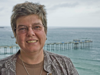
The asteroid belt is a region lying between the orbits of Mars and Jupiter that contains billions of asteroids, ranging from some as small as pebbles to as large as nearly 1000 km across. Sara Russell explains how we can use asteroids to help us unravel how the solar system formed and to cast light on questions such as how the Earth got its water and organic materials.
Photo courtesy of Tammana Begum

Most rocks were formed many millions of years ago. Since then, some have been largely left alone, while others have been baked at high temperatures and buried at great depths. Clare Warren explains how we can now uncover remarkably precise histories of such rocks, even if they have been through more than one episode of such extreme treatment.
Photo courtesy of The Open University

Steve Sparks has turned our ideas about volcanoes upside down. Not quite literally, but by applying the physics of fluid motion to the rocks and magma below volcanoes, he discovered that magma forms slowly at much greater depths than previously thought, eventually forming an unstable blob that forces its way up through the overlying rocks to erupt from a volcano.

Why look to another planet to reveal something new about the Earth? Dan McKenzie describes an ingenious way of using the data sent back from the Magellan Venus orbiter to discover that Venus is covered with an elastic plate about 30 kilometers thick. Explaining this very unexpected result revealed something extraordinary about the Earth.
Photo Courtesy of James Jackson
In this episode, James Jackson explains what happens, geologically-speaking, during an earthquake, why they strike where they do, and why earthquake-prone places are such attractive places to live.

Mike Searle applies the theory of plate tectonics to explain what causes mountains of all kinds to form. They range from enormous mountain belts such as those that stretch from the Himalaya to the Alps, to mid-ocean volcanoes such as Hawaii.
If you’d like to be notified when a new episode of Geology Bites becomes available, you can set that up on the Contact page.