
Claude Jaupart on Whether the Earth is Cooling Down
Claude Jaupart is Professor of Geophysics at the University of Paris and the Institut de Physique du Globe. His research aims to understand the physics of igneous processes in the Earth, such as those occurring in volcanic eruptions, magma chambers, and the mantle. He reveals how heat flow out of the Earth is highly variable on all spatial scales and that Earth has been cooling slowly for the past 2 billion years at least, which still leaves plenty of heat to drive today’s plate motions and volcanism.
Listen to the podcast here or wherever you listen to podcasts.
Scroll down for illustrations that support the podcast. And add your comments at the bottom of the page.
Note - playing the podcast is not supported on Internet Explorer; please use any other browser, or listen on Spotify, Apple Podcasts, etc.
-
This transcript was generated automatically and lightly edited for readability.
Oliver Strimpel: This is Geology Bites with Oliver Strimpel. We know the Earth was born as a baking inferno, so the presence of a relatively cool surface today suggests that the Earth has cooled a lot since it formed. But the very thin crust on which we subsist is not representative of the Earth as a whole. And although some heat must be escaping from the Earth, there are also ongoing sources of heat. So the answer to the question as to whether Earth is cooling down is not straightforward.
Claude Jaupart is professor of geophysics at the Université de Paris and the Institut de Physique du Globe. His research aims to understand the physics of igneous processes in the Earth, such as those occurring in volcanic eruptions, magma chambers and the mantle. He's especially interested in how heat flows out of the Earth, particularly in continents. He has measured heat flow in the field, mostly in remotest Canada, where he discovered surprisingly low heat flow. Claude Jaupart, welcome to Geology Bites.
Claude Jaupart: Thank you, Oliver.
Oliver Strimpel: In my introduction, I said that we know the Earth was once a baking inferno. There can't be much direct evidence left from the very beginning of the Earth. So do we simply infer this from our knowledge of the sources of heat?
Claude Jaupart: Yes. There are two main mechanisms that are involved. First, you must gather material from outer space, and all this material comes in through meteorites and fragments of other planets that come crashing down, and each one of these impacts releases heat. So there's an enormous amount of heat that's released this way. And there is another phenomenon, because we know that the Earth has differentiated: now there is an iron core right in the middle. And this core formed when the Earth was young and hot, because you have to separate the heavy iron-bearing minerals so that they could sink to the center of the Earth. And this very process, the sinking of this iron-enriched material, is also releasing heat, because there's friction involved when one material moves with respect to another. So these two sources of heat were enough to have elevated Earth's temperatures to above the melting point.
Oliver Strimpel: What about the giant impact that formed the Moon?
Claude Jaupart: There was an impact by a planet which was about the size of Mars, and that impact just shredded a bit of the Earth out, and this formed the Moon. And this impact was so energetic that it also raised temperatures way above the melting point. So at that point, this impact in fact set the clock back to zero, because there was enough heat to remove everything that had been happening since the Earth was formed in the first place.
Oliver Strimpel: We believe that tidal forces are keeping some of the moons of Jupiter, such as Io and Europa, and Saturn's moon Enceladus, hot. Is that something that keeps the Earth warm as well?
Claude Jaupart: No, in our case it's negligible. A lot of the tidal force comes from the Moon. There's a bit from the Sun as well. But these are small, and all of this gets dissipated in the oceans. A bit of it gets dissipated in the solid Earth, because the solid surface is also moving up and down, just as the ocean surface does. But there's a very tiny amount of energy that's released this way.
Oliver Strimpel: Leaving aside the question as to whether the Earth is cooling down for a moment, the Earth must be losing some heat today. It can't be very much, because apart from near volcanoes or hot springs, the surface of the Earth is not discernibly warm. About how much heat are we actually talking about?
Claude Jaupart: If you average out all the heat that's being released by the Earth, because that varies from point to point, the total average is about 80 milliwatts per square meter. That is, over an area of 1,000 square meters, you're losing 80 watts, and 80 watts is basically what it takes to light up a light bulb. So you can see that's not a lot of energy by our standards. But of course, geology doesn't work on seconds; human beings do. So in fact, you must not worry about the rate of heat release per second, but the rate of heat release per million years. And if you scale up this number that I just quoted to a million years, that's an absolutely enormous amount of energy. That's the energy that's going to generate volcanic eruptions, and that's also the energy that's able to drive continental drift.
Oliver Strimpel: It feels warm when you go down a coal mine or something like that. Presumably we're feeling the heat flow from the Earth's interior when we feel that warmth, are we?
Claude Jaupart: Yes. It was very clear to earlier researchers that the Earth was hot inside, simply because as they went down in mines, the temperature kept rising. So it was very clear that the Earth was hot.
Oliver Strimpel: OK, let's talk about how we measure the heat flow.
Claude Jaupart: We use a basic law of heat conduction. That is the mechanism that carries heat through a solid, and it's analogous to Ohm's law for electric current. In our case, the potential is the temperature, and when there's a temperature difference between two points, heat flows from hot to cold, and the heat flow is analogous to the electrical current. So what we do is we measure not only the temperature difference between two points, but the temperature gradient, and then we measure the ability of rocks to carry that heat, which is measured by conductivity, which is the inverse of resistance. So the heat flux then is simply the conductivity times the temperature gradient.
Now, conductivity is measured in the lab. You take rock samples from the field and subject them to a known heat flux and measure the temperature difference, so you can work out what the conductivity is. And then in the field, you measure the temperature gradient in very deep boreholes, and this is done by drilling holes in the ground and measuring the temperature structure when you go down. These measurements are not easy, because you don't control the environment. And as we discussed in the previous question, the heat flow is very small, so it can be perturbed by many processes. So you have to go very deep to have a very large temperature difference, so that you're sure that you're really measuring the heat flow that's coming out of the Earth.
Oliver Strimpel: Is it very variable? I mean, does it vary on small timescales and space scales when you go down the borehole?
Claude Jaupart: In the shallow parts of boreholes, the rocks are permeable, so there's water going through. If water is flowing through the rock, it carries heat, and that's something we don't measure by the technique we have been discussing. And so you must avoid this at all costs, because that's not heat that you can account for. So you must go deeper than the parts where there's water circulation. And basically water circulates in pores and cracks that get closed with increasing confining pressure, so you just have to go deep enough that all these interstitial spaces through which water can circulate get closed. And in practice, you must go down to at least 200 meters' depth, say 600 feet, and by then there's no detectable water motion. We can check that, because we measure temperature with a very high accuracy, one thousandth of a degree. So at this precision, any small water motion or any disturbance gets recorded in temperature. So when we measure temperatures in a borehole, we make sure the temperature is absolutely steady over a time that is sufficiently long. In practice, that's about 10 to 15 minutes. And if the temperature does not change by one thousandth of a degree, we're pretty sure that nothing is happening there.
Another factor that we need to take into account is that the Earth has been exchanging heat with the atmosphere, and as we all know, there have been climatic changes in the past, a recent one, but also a much longer one associated with the glacial cycle. So in the shallow part of a borehole, the Earth is still equilibrating with the current temperature, and it has a record of the past temperatures. So we need to go sufficiently deep that we are not sensitive to those changes, which are not linked to the Earth's heat loss.
Oliver Strimpel: How deep do you go, in fact, in some of these boreholes?
Claude Jaupart: Well, for us, the deeper the better, because the deeper we go, the more we can check that everything is OK. What do I mean by "everything is OK"? If you have a very deep borehole, you can measure the heat flow through, say, one part of the borehole and compare it to the heat flow through another part of the borehole. And if these two heat flows are the same, then you're sure that's the heat that's being lost out of the interior of the Earth. If there's a difference, then something has happened between these two different parts of the borehole. So that's why, when we go very deep, we have many, many different ways of checking that the heat flow is basically the same, whether you are at a kilometer depth or at 500 meters' depth. In practice, we measure boreholes that are typically more than 600 meters deep, and we are able to measure the temperatures down boreholes that could be as deep as 2.5 kilometers.
Oliver Strimpel: Wow. Now, I presume you're not drilling these boreholes yourself.
Claude Jaupart: Oh, no. A kilometer-deep borehole is about a million dollars. So we use boreholes that have been drilled for other purposes. The main source of boreholes for us is the mining industry. When they explore for mineral deposits, they drill holes to make sure that the deposit that they're looking for is there underground.
Oliver Strimpel: You're basically piggybacking on the exploratory boreholes that other people have drilled for prospecting purposes.
Claude Jaupart: Exactly. Another reason is that the very operation of drilling a hole will perturb the rocks. It heats up the rock, because there's friction between the drill bit and the rock. So we need the borehole to cool down and equilibrate again with all the rocks around it, and that takes something like several months. So were we to drill our holes ourselves, we would have to go to the field, get permission to drill the hole, and drill it, and then wait several months before we can record it, and that's clearly not very good for an academic research team. We use boreholes that have been drilled a long time ago. Sometimes we are able to penetrate holes that were as old as 50 years.
Oliver Strimpel: I know you've done a lot of work in the Canadian Shield, and to get good coverage, you go to extremely remote places. How do you get there?
Claude Jaupart: Well, in Canada, we go to remote places simply because we just want to get the heat flow map, and that's absolutely independent of whether there are roads or easy access to those places. So we get dropped by planes or helicopters, and we end up in places that sometimes are completely away from any road. The people who drilled the holes go in the winter, when everything is frozen, so that trucks can go very easily. But we can't do this ourselves, because making measurements in the cold Canadian winter is too complicated and would require a lot of equipment. So by the time we go in, everything has thawed, and so we're walking through marshes and wet areas, and get dropped in the middle of nowhere. So that leads to cool, interesting things. That's one of the things I enjoy, because you always get surprises. We made measurements, for example, at the very northern tip of Canada, near the Hudson Strait. There's no one there. It's beautiful. And we set up our measuring gear. It takes us about a day to log a borehole, so you're sitting there and waiting, and suddenly you see an Arctic fox that stayed with us for the whole day. It was very curious, and was apparently happy to have some company. There are also disappointments, because in Canada there are beavers, and beavers are very bad for us, because sometimes they erect dams and then they flood the whole area. So in several cases, we had these fantastic boreholes that were located just where we wanted to make the measurements, and by the time we got there, they were beneath a pool of water, and we could not therefore make the measurements.
Oliver Strimpel: What about measuring the heat flow under the oceans?
Claude Jaupart: Drilling a hole in the bottom of the sea is time-consuming and very costly. So what we do is we use the fact that there are sediments, and sediments are loosely consolidated; they can be penetrated. So what you do is you drop a probe, a deep probe. It's just like a thin cylinder that goes through the sediment, and in this cylinder you have several thermistors. They are thermometers that record temperatures, and then you can record the temperature profile through the sediment.
Oliver Strimpel: There must be quite a few challenges to measuring the heat flow at the bottom of a deep ocean.
Claude Jaupart: Well, it's a terribly difficult enterprise, because you have to shove a probe down into sediments, and those sediments are lying at depths which might be four kilometers or even more. So you have to shove the probe in, and you have to make sure that it's vertical, because if it's not vertical, then you're not recording the vertical gradient of temperature; you're recording the gradient at an angle, which is not what you're looking for. Furthermore, your probe cannot move. Once you've shoved it into the sediments, it must remain absolutely immobile, because any small motion of the probe will generate some heat, because you have friction of the probe against the sediments. Given that we are making measurements of very small temperature differences, this minor amount of shear will generate heat that can mess up our measurements. And you're standing on your ship, which is four kilometers above, in rough seas; sometimes there might be huge waves. And you have to make sure that your probe is totally immobile for about one or two hours, because it takes one or two hours for temperatures to equilibrate and for you to be able to make reliable measurements. The old saying was: never repeat a heat flow measurement, for fear of getting a new measurement that deviates from the previous one by more than a factor of 10.
Oliver Strimpel: You've been measuring the heat flow coming out of the Earth directly. Are there other observations that can yield an indirect measurement of the heat flux?
Claude Jaupart: Yes, we use the depth of the seafloor. What happens is that as the oceanic lithosphere cools down, it contracts, and this is what explains the fact that we observe the seafloor to deepen as we go away from a mid-ocean ridge. That deepening is simply due to the fact that the lithosphere cools down and contracts and then gets deeper. So the way it contracts tells us how much heat is being lost. Of course, when you measure the depth of the seafloor, you're sensitive to very shallow structures. There might be a seamount here; there might have been some turbidity current with extra sediment cover there. So there is a roughness in the topography. But by and large, over a large scale, the deepening of the seafloor is just a record of the heat that's being lost out of the seafloor.
Oliver Strimpel: And that works on all oceans that have spreading ridges, which I guess all of them do, right?
Claude Jaupart: Yes. That's one of the beauties of the physics. The fact that there was a mid-ocean ridge was known since the 19th century. It was one of the big questions: what is the origin of the oceanic mountain belts? And it's quite different from what happens in the continents. In the oceans, what is happening is simply the cooling, and we only realized that in the 1960s, 1970s. But by then we knew that the deepening of the seafloor away from a ridge, measured as a function of distance, was absolutely the same in all oceans. You could measure it in the Atlantic Ocean or in the Pacific Ocean or in the Indian Ocean, and you had exactly the same deepening. So that was telling us that there was a single physical mechanism at work there.
Oliver Strimpel: What do the results of all these heat flow measurements tell us?
Claude Jaupart: We know how much heat is being lost by the Earth. That's one aspect, and it's telling us two things. One is that a large fraction of the Earth's heat loss goes through the oceans, and they're a very big contributor, for two reasons. One is that it's the largest surface which is losing heat, but also, per unit surface, it's also where the heat flow is largest. Then if you go to continents, it's a different story, because there are young continents, where you're sitting next to a volcano. Clearly you're going to have a large heat flow, because the magma that's been emplaced beneath the volcano is cooling down. So that's extra heat. But when you go to very old places, such as the Canadian Shield (the Canadian Shield on average is more than 2.5 billion years old), we know that by this time, every transient heat loss due to the formation of the continent has decayed away. So we still measure differences of heat flow, simply because continental rocks are full of radioactive elements, and these radioactive elements release heat as they decay. Depending on which rock you're standing on, there's more or less energy that's being produced, and that is reflected in the heat flow. So in continents, what we are measuring is, by and large, the amount of heat that's released by radioactivity in crustal rocks.
Oliver Strimpel: Does the heat flow we measure vary on quite small spatial scales? You mentioned the presence of volcanoes. Do we see that kind of variation elsewhere as well?
Claude Jaupart: Heat flow varies on all sorts of scales. On a very large scale, in a continent, for example North America, if you measure heat flow close to the west, you have active volcanoes. You also have extension: the Basin and Range is the province where the Earth's lithosphere and crust are being thinned. So that's a very active region, where the heat flow is large. When you go to the Colorado Plateau, the Colorado Plateau itself was a site of magmatic activity about 100 million years ago, and so there's a big jump in the heat flow when you go from the Basin and Range to the Colorado Plateau. Then when you go further east, you go to the older parts of the North American continent, and you still have variations of heat flow, but on a smaller scale, that is, the scale of an individual rock body. For example, from one pluton to a sedimentary basin, the change of geological setting will be reflected in the change in heat flow. So you have a large-scale variation, which is due to the story of the continent, a young continent or an old continent, and within a continent of a given age, you have smaller-scale variations that are due to the geological fabric of the continent.
Oliver Strimpel: Do you see much higher heat flow in the tens or hundreds of kilometers around Yellowstone, for example?
Claude Jaupart: Yellowstone is a place where the Earth is losing an enormous amount of heat, and not by this mechanism we were talking about, conduction. It's mostly releasing heat because there are fumaroles, that's hot gases, and there's a gigantic amount of magma that has been emplaced in the Earth's crust beneath Yellowstone. So when we measure heat flow close to the axis of activity, we still measure a high heat flow, but we're only measuring part of it, because most of it is actually being lost through hydrothermal circulation in cracks. But as we go away from Yellowstone, we measure a decrease in the heat flow, simply because we're getting away from the big heat source, which is the magma reservoir that's beneath Yellowstone.
Oliver Strimpel: Overall, averaging for the Earth as a whole, are we currently losing more heat than we're generating from radioactive sources?
Claude Jaupart: The story of the heat sources and the heat flow is a complex one. So we can measure this today, and then we can infer what happened in the past with models. But let's talk about what we do today. So today I have all these measurements in the oceans and the continents, and I can figure out how much heat the Earth is losing. We talked about it: on average, it was 80 milliwatts per square meter. And now I can calculate how much heat is being produced by radioactivity, because I have some idea about the total amount of radioactive elements that are in the Earth. All the geochemical evidence and all the models for the Earth's construction are such that the radioactivity can only contribute half of what we're losing today. So we're losing today twice as much heat as we're producing, so we have a net loss of heat. So the Earth is cooling down.
Oliver Strimpel: Does that translate into a temperature loss rate of the Earth?
Claude Jaupart: Yes. If you translate this to temperature, we're cooling down at a rate of about 100 degrees per billion years.
Oliver Strimpel: OK. So well over 1,000 degrees now, so we've got a long way to go before we cool down.
Claude Jaupart: In fact, it is a very small rate of cooling, and this is why geological activity has been sustained for so long. Because if the Earth had cooled down much faster, then everything would be dead by now.
Oliver Strimpel: As we go back in time, there must have been more and more radioactive heat generation. Was there actually a time when the Earth was heating up before it started cooling down?
Claude Jaupart: Well, that's the billion-dollar question. There is some evidence that we reached a temperature maximum sometime in Earth's history. So it's clear that today we're losing more heat than we're producing. It's clear also that because of radioactive decay, we had to lose more heat in the past, because the radioactive elements had not decayed as much as they've decayed today. But we also know that the heat flux should also go up as we go back in time, simply because as the Earth got hotter, it became easier to deform, and then it could lose more heat. It was more efficient at mixing up its interior and shedding its heat. So we have both the heat loss and the heat production that go up simultaneously with time. As of now, we have clear evidence that the Earth has been cooling down for between two and three billion years, and we reached apparently some maximum at about 3 billion years ago.
Oliver Strimpel: Do we have any observations that we can use to corroborate these conclusions that the Earth was hotter in the past?
Claude Jaupart: Yes, we can use the composition of lavas. It's the Earth's mantle which is producing the primitive lavas that eventually feed all sorts of volcanic activity; it's the Earth's mantle that's melting. Now, the Earth's mantle is not a pure substance, so it does not melt at one temperature; it melts over a temperature range. Now, depending on the temperature at which you are melting, you're melting different proportions of the mantle, and hence you're generating liquids that have different compositions. So the hotter the mantle, the more primitive the lava. So by looking at the lava composition in terranes of different ages, we get a record of the temperature at which the Earth's mantle got molten, and so we can transform the composition of lava into mantle temperature.
And when we do this, we observe that as we go back in time, the mantle temperature goes up, and it goes up to about 3 billion years. As the calculations tend to indicate, it's consistent with what we observe in these lava compositions. But for ages that are older than 3 billion years, first, we don't have that many samples. As we go back in time, there are not a lot of lava flows that are still around, and they've been altered, being exposed to the winds and to the waters, and they've been chewed up in mountain belts. So for older than 3 billion years, we're not quite sure. There's data that suggests that the temperature doesn't change much, and that's about it.
Oliver Strimpel: So you mentioned that the fact that the Earth is still very hot explains that it's still very geologically active, and it's driving that activity. So do our measurements and our understanding of heat flow help us understand how plate tectonics works?
Claude Jaupart: Plate tectonics is in fact the major agent for losing heat. You cool a plate at the surface. You're placing material at the surface; it's coming from the Earth's interior; it's hot; then it cools down, and this is what is responsible for the deepening of the seafloor with age. And then by the time you've cooled quite a lot of material, you subduct it. You shove it into the Earth's interior, and that, of course, acts to cool the Earth's interior, because you just carry cool stuff to the interior and mix it with the surroundings. So plate tectonics is a major cooling agent. So how the Earth is losing heat and plate tectonics are two aspects of the same problem: if we understand the heat loss, we also understand the rate at which we've been subducting things in the past. And the rate at which subduction has operated in the past tells us the intensity of mantle convection, tells us how many plates we were generating, and other aspects like that. So yes, the heat loss story is actually providing us with a very strong constraint on the operation of plate tectonics in the past.
Oliver Strimpel: The simple-minded model of convection of the mantle driving the plate motions has some major challenges, such as the scale of the plates and how subduction actually starts.
Claude Jaupart: If you look at any system that's convecting, usually what you find is that the horizontal scale of motion, that is, the distance between an upwelling and a downwelling, is about equal to the depth of the system. That is, if you have a cup of water which is 5 centimeters deep, you will have upwellings and downwellings which are separated by about 5 centimeters. Now, on the Earth, we don't have this. The Earth's mantle is about 3,000 kilometers thick, and we have these plates that are extraordinarily large. The Pacific Ocean extends over something like 10,000 kilometers, so it is much wider than it is deep. That's a major problem; we don't understand this very well. And the other problem is, we don't understand very well why plates subduct. We know it's happening, we know it's essential to cool the Earth, we know it's bound to happen, but why does it happen in the way it happens on the Earth, where it is so difficult to subduct? Why do we have to wait for 10,000 kilometers to see a subduction zone in the Pacific Ocean? This is something we don't understand very well, and that's the key question, because if you don't understand subduction, you don't understand convection, and you don't understand heat loss.
Oliver Strimpel: Do you have any ideas as to how we might be able to explain these puzzles?
Claude Jaupart: It's difficult, because we don't have that many records of subduction starting. We have subduction that has been going on for a long time, and so any record of how it started is long gone. So it's not an easy question. There are two kinds of theories. One is that the Earth has been deforming quite a bit from day one, so you have zones of weakness that are still lying about. For example, the collision between two continents will leave a scar, a zone which will remain weak for quite some time. And by the time you have an ocean built up in the same area, this area is still weak, and this is maybe how you can generate subduction in this particular place. Another concept is that we have continents and oceans. Continents can't subduct; they provide us with anchors to anchor motion. So you do have to make sure that the motions that you're generating in the oceans are consistent with the presence of continents. So in some models, the continents are actually those which force the subduction.
Oliver Strimpel: What are you currently working on in your research?
Claude Jaupart: Well, right now, I'm working on the Earth's heat loss. I'm interested in the way that heat loss is connected to continental growth. Continents today occupy something like 40% of the Earth's surface, but in the past we started with probably no continents, and slowly continents have been growing. And continents do two things. One is that they collect radioactive elements, and those radioactive elements will not participate in driving mantle motions, because they are just stuck in these rigid continents. So that's one aspect: continental growth acts to deplete the Earth's mantle in radioactive elements. The other aspect is that continents are thick and they don't lose that much heat. So you see, the continents are doing two things: they reduce the area through which you can release a lot of heat by oceanic spreading, and they take radioactive elements out of the mantle, and hence out of the engine that's powering everything. So these are two major aspects that are intimately linked to the Earth's thermal history. And that's what I'm working on: linking the story of continental growth with the story of mantle convection and plate tectonics.
Oliver Strimpel: If you had unlimited funds for your research, how would you use them?
Claude Jaupart: If I had a lot of money, I would go and explore places that we don't know yet. We understand quite well what's going on in North America, but there are large bits of North America that we don't know very well geologically. We don't know the northern parts of Canada, first because they're under a lot of snow and ice, and surprisingly enough, this is also where the continent is the oldest. So we're missing a big record of the early evolution of the North American continent, because we don't have a proper geological map and we don't have samples from those areas. Similarly, when you look at the oceans, we have a very good view of the ocean floor in the Pacific or the Atlantic, but when you go to the Arctic Ocean, we don't have that much resolution. There's a mid-ocean ridge there; we don't know exactly how it's structured. And last but not least, there's a big continent lying at the South Pole, Antarctica, and we don't know its geological structure very well. There's an active volcano there, Mount Erebus, a beautiful volcano. There's a mountain belt, but we don't know its age. So we don't have access to a certain part of Earth's history. So what I would do is go and explore these unexplored places.
Oliver Strimpel: Claude Jaupart, thank you very much.
Claude Jaupart: Thank you, Oliver.
Oliver Strimpel: For more about Geology Bites, as well as pictures and illustrations that support this podcast, you can go to geologybites.com.
Podcast Illustrations
All images courtesy of Claude Jaupart unless otherwise indicated

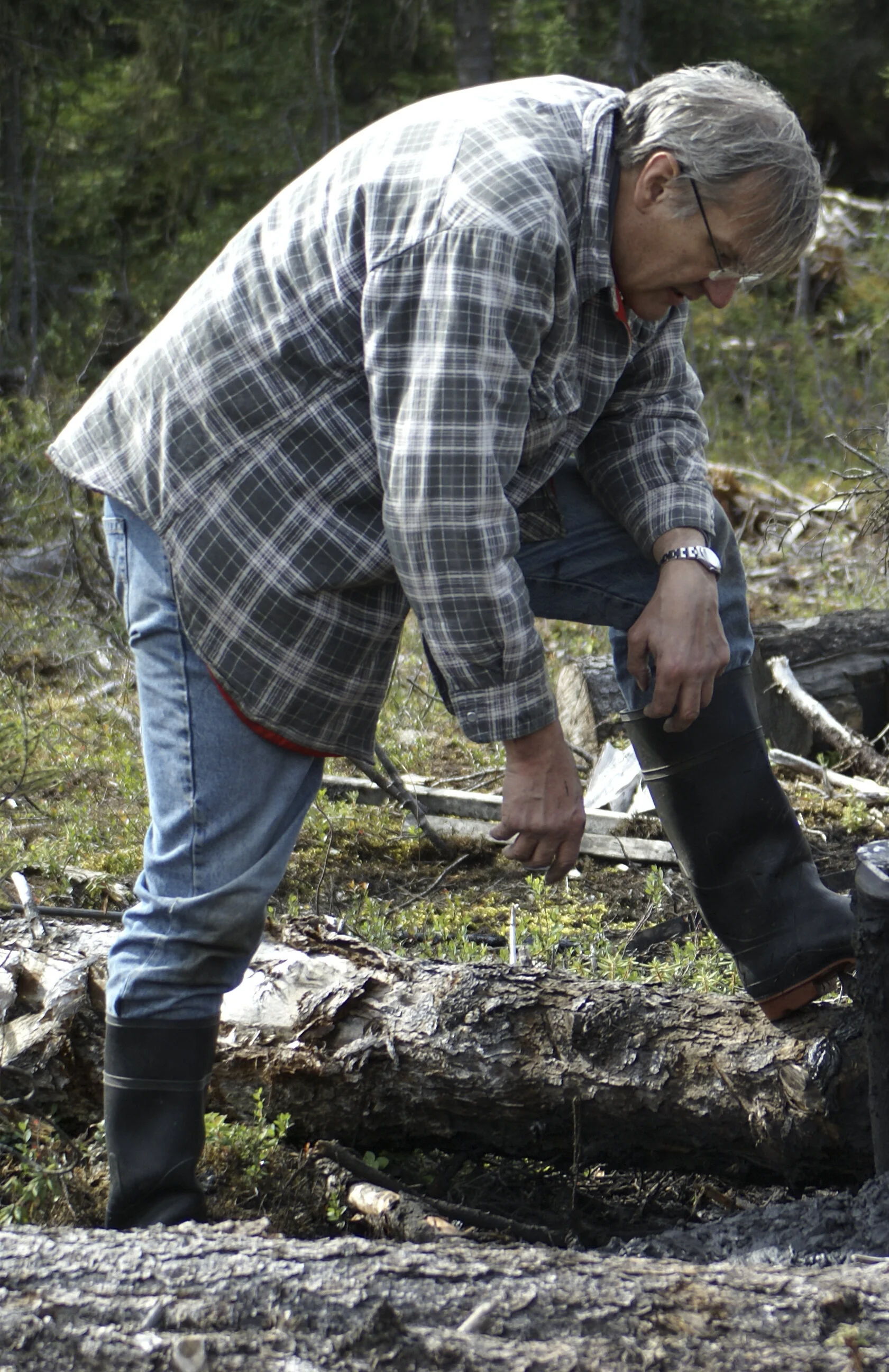
Making a heat flow measurement down a deep borehole in the far north of Canada. Claude Jaupart describes the steps that need to be taken to ensure that an accurate measurement of the Earth’s heat flow is obtained.

Collecting borehole rock samples for thermal conductivity measurements back in the lab.

Borehole site in northern Canada on the Hudson Strait.

Borehole at the Hudson Strait site showing the cable that connects to the temperature-measuring device that is lowered down the borehole. While most borehole measurements are conducted at depths of a few hundred meters to a thousand meters, the deepest boreholes reach depths of 2.5 km.

An Arctic fox keeps Claude Jaupart’s team company for a day.

Deploying a Bullard probe for measuring heat flow in sediments on the sea floor.

History of the Earth’s mantle temperature as determined from analysis of lava compositions.

Map of the heat flux in North America.

Temperature profiles down two deep boreholes in Canada.