
Craig Jones on the Iconic Landscapes of the American Westerns

Craig Jones is a Professor in the Department of Geological Sciences at Colorado University at Boulder. He studies elevated topography in continents, primarily in the western United States, using seismology, gravity measurements, paleoaltimetry, and petrology. He explains how the rocks forming the iconic landscapes of the American West were deposited, what happened to them over the subsequent hundreds of millions of years, and how present-day climate has laid them bare.
Listen to the podcast here or wherever you listen to podcasts.
Scroll down for illustrations that support the podcast. And add your comments at the bottom of the page.
Note - playing the podcast is not supported on Internet Explorer; please use any other browser, or listen on Spotify, Apple Podcasts, etc.
Podcast Illustrations
All images courtesy of Craig Jones unless otherwise indicated.
Colorado Plateau

The Colorado Plateau spans the states of Colorado, New Mexico, Utah, and Arizona.


Monument Valley

A scene from the 1939 movie Stagecoach, the first major motion picture to be shot in Monument Valley.
Courtesy of Walter Wanger Productions


The Monument Valley buttes result from the erosion of various layers of sedimentary rock having differing strength. The sheer cliffs comprise the De Chelly Sandstone, originally formed as sand dunes, with the Organ Rock Shale, consisting of tidal mudflats, forming the gentler slopes, the base, and much of the intervening flats. The underlying Cedar Mesa Sandstone, which forms the erosion-resistant plains between the buttes, was a marine shoreline sand deposit. Thus, the sequence of rocks here reflects the emergence of this landscape as material eroded from the Ancestral Rockies covered this region.
Present-day erosion eats away at the shale, undermining the sandstone, which falls away in blocks. Craig Jones uses the analogy of dominos on a beach falling away when the underlying sand is disturbed.
Courtesy of Wayne Ranney
Zion National Park

Cliffs in Zion National Park of the Navajo Sandstone. The gentler slopes at the base are the Kayenta Formation, which consists of river and floodplain deposits. Note the lower Navajo is red and the higher part is white, which probably reflects changes to the rock long after it was deposited, most likely bleaching by organic fluids trapped for a time in these rocks.
Courtesy of Daniel Mayer

In Zion National Park cliffs, horizontal lines are old erosion surfaces; inclined lines are crossbeds, formed by slight differences in the amount of silt in sands on the lee slopes of ancient sand dunes. These are truncated at the top when the dunes moved on but left a thick deposit of sand. Winds would have been from left to right here, as the crossbeds, which were the lee slopes of the dunes, are inclined to the right.
Bryce Canyon National Park

The colorful cliffs and hoodoos of the park are made up of the Claron Formation, which consists largely of lake deposits of silt, lime, and sand. Some layers are more resistant due to their chemistry, and they protect the rock below. Because these rocks are cut by vertical joints that permit erosion of the rock beneath, as erosion proceeds, pillars of protected rock are left behind.
Courtesy of Tony Jin
Grand Canyon National Park

The Grand Canyon with the Colorado River.
Courtesy of Lennart Sikkema

The stratigraphy of the Grand Canyon.
Courtesy of the National Park Service
Alabama Hills, Sierra Nevada
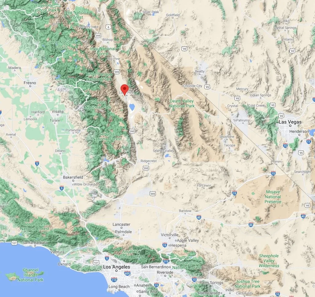
The Alabama Hills lie on the eastern edge of the high Sierra Nevada and about 50 km west of Death Valley.
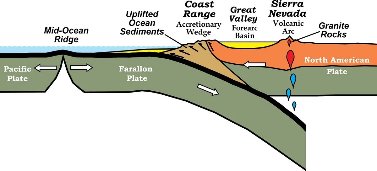
The long-lived subduction of the Farallon plate created the Sierra Nevada, whose granites were intruded at a depth of 5-30 km below a chain of volcanos. The volcanic carapace has been eroded away, exposing the granite below.
Courtesy of Robert J. Lillie and Wells Creek Publishers

The glacially sculpted landscape in the background is the Great Western Divide within the Sierra Nevada and Sequoia National Park. The image shows avalanche chutes that terminate along a line corresponding to the top of the glaciers that once flowed through the valley.

Sunrise view from the summit of Mt. Whitney reveals the jagged and diverse forms of erosion along the crest of the Sierra Nevada. This is a landscape shaped by ice, as evidenced by the glacial lakes, U-shaped valleys, and cirque headwalls visible here. Owens Valley (home to the Alabama Hills) is at the right, largely lost in haze. Nearly all the rock here is a form of granite emplaced about 82 million years ago.

View of the Sierra crest from the Great Western Divide illustrating landforms of the glaciated Sierra. Mt. Whitney is at upper left, Mt. Langley at upper right. The U-shaped canyon at the bottom center is a classic glacial landform, and is truncated by the Big Arroyo cutting across the view, with the far wall of that canyon forming the edge of the Chagoopa Plateau, an older landscape now dissected by these glacial canyons. On the far side, the Sierra crest has glacial cirques, most evident near the center of the photo.

The lumpy “Oldest Hills” of the Alabama Hills in the foreground lie below the petrologically similar rocks of Mt. Williamson in the upper left. The dry environment of the Alabama Hills leads to a form of physical weathering common to granitic rocks, where the mineral grains within the rock (quartz, feldspar, and mica) break apart at grain boundaries, leaving granitic sand, which is easily carried off by wind or water. In contrast, rocks high in the Sierra are dominantly broken apart by ice freeze-thaw weathering.
Cross section through the Isabella Anomaly projected onto a plane that rotates about the center of the anomaly. The plot shows the wave speed of P-waves up to 300 km below the Sierra Nevada. Craig Jones suggests this might be showing a chunk of heavy lithospheric mantle that dropped off the base of the lithosphere under the Sierra Nevada, causing them to rise over the past 10 million years. This is the same mechanism proposed by Peter Molnar for the Tibetan Plateau.
Visualization of dense lithospheric mantle dripping into the asthenosphere below. The areas in yellow are rising up as the dense material below thins and is replaced by lighter material, and the cyan areas are sinking as more dense material accumulates in the drip. The purple represents the dense lower crust or upper mantle rocks (garnet pyroxenite) that were under the Sierra.
The High Plains
A mechanism for creating the high plains to the east of the Rocky Mountains proposed by Craig Jones.