
Esther Sumner on Turbidity Currents
Listen to the podcast here or wherever you get your podcasts.
Turbidity currents are massive underwater events, sometimes stretching for hundreds of kilometers and lasting for days. But since they mostly occur in the deep ocean, we have rarely observed them directly. In the podcast, Esther Sumner describes how she and her team instrumented an active submarine canyon with “smart boulders” and acoustic doppler current profilers to reveal how sediment moves across the seafloor. She also tells us about the day her team accidentally flew an underwater robot into a live turbidity current, which swept the rover down the Mendocino canyon off the California coast. She is an Associate Professor of geology and geophysics at the University of Southampton.
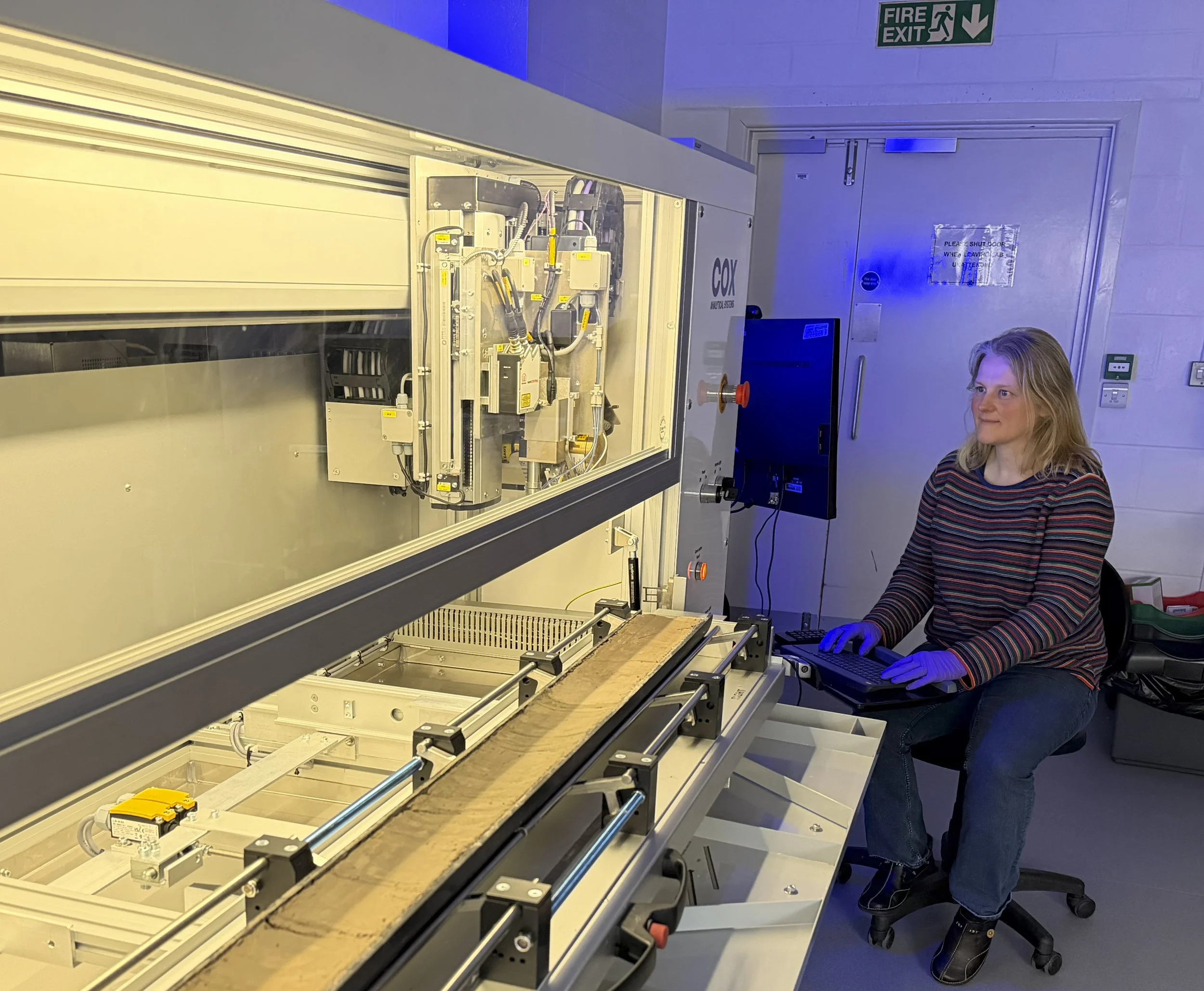
In the image, Sumner is scanning a sediment core.
Podcast Illustrations
Images courtesy of Esther Sumner unless otherwise indicated.
Turbidite Anatomy

The steeply-dipping rocks below Hutton’s famous unconformity at Siccar Point in Scotland are Silurian marine turbidites. They appear in the lower right half of the image around the puddle.
Rob Strachan
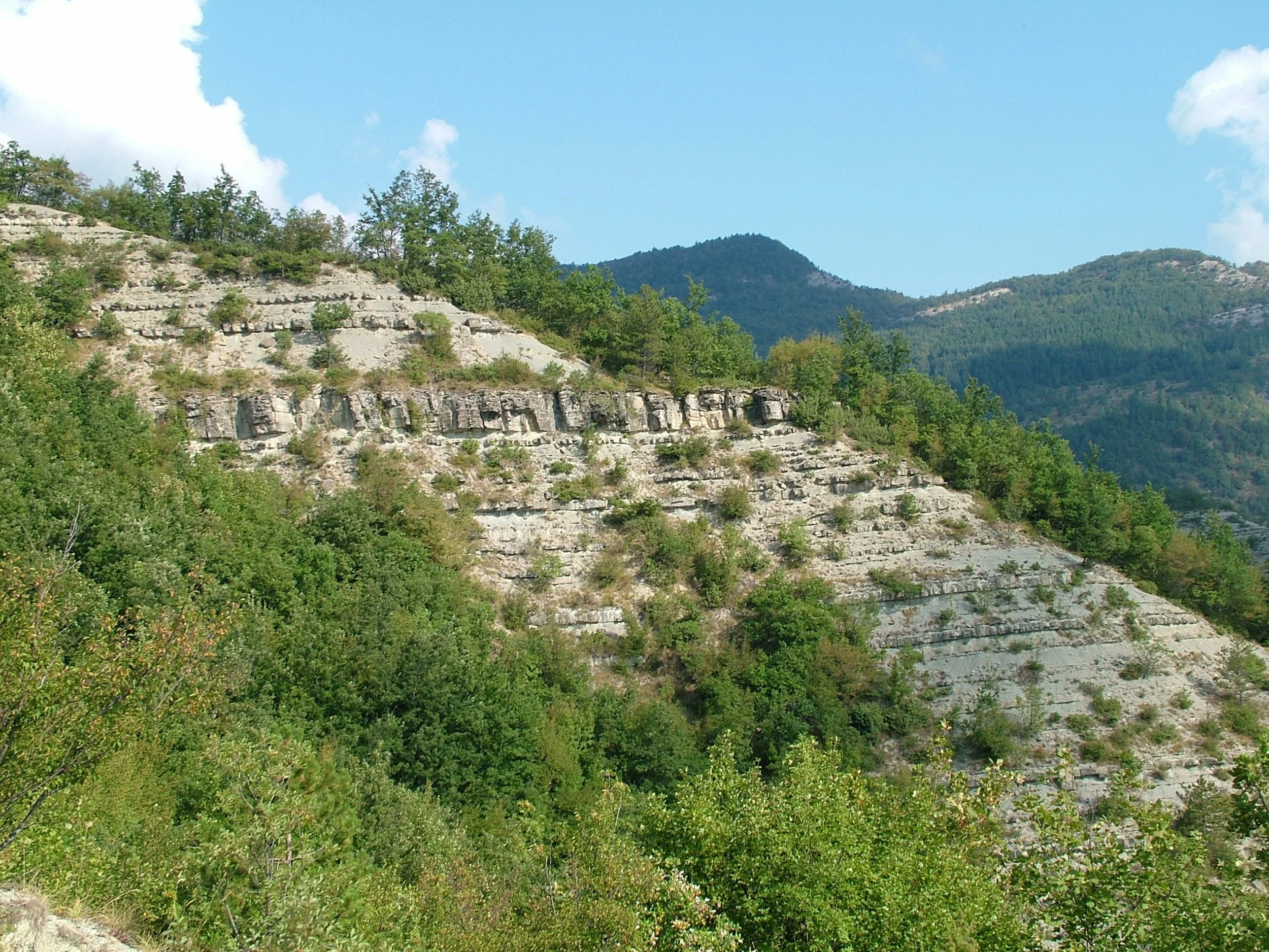
Outcrop of turbidites in the Italian Apennines showing the repeated bedding draped across an entire mountainside.
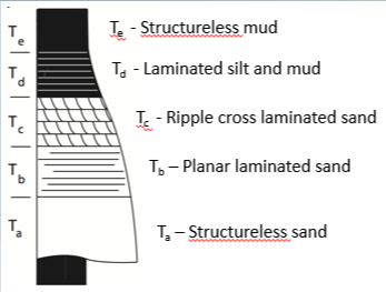
The classic facies succession for a single-flow turbidite is called the Bouma sequence. The diagram shows the sequence first described by Arnold Bouma in 1962, with five distinct, vertical layers representing deposition from a waning turbidity current. Multiple turbidity currents (a turbidite sequence) form repeated graded sequences. Complete Bouma sequences are rare and turbidites often contain other sedimentary structures as well.
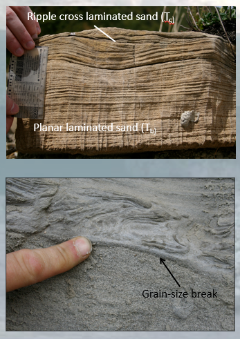
Turbidite outcrops showing various typical structures. Top left: two of the five Bouma divisions: planar laminated sand and ripple cross-laminated sand. Bottom left: grain-size break within a single turbidity current. Below the break is structureless sand, above the grain-size break is convolute lamination (a type of dewatering structure). As Sumner mentions in the podcast, it is quite rare to see the textbook Bouma sequence in the field.
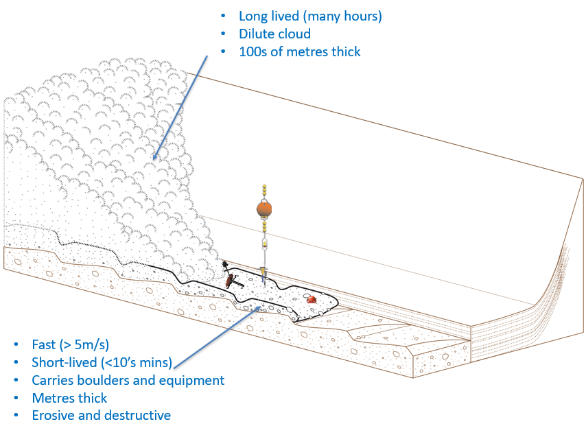
Diagram of a turbidity current showing two main components: a fast, short-lived destructive base flow and a long-lived, dilute cloud that rides above the base flow. The base flow can sweep boulders and experimental equipment along with it.
Submarine Canyons and Fan System
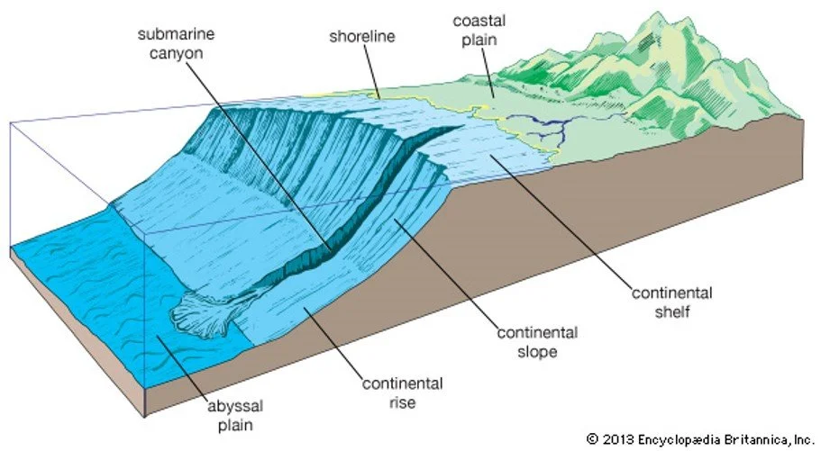
Turbidity currents often flow down submarine canyons. Such canyons are erosional conduits that enable sediment to be transported from the terrestrial and shallow marine environment out into the deep sea. In the diagram, the vertical scale is greatly exaggerated.
Encyclopaedia Britannica, Inc.
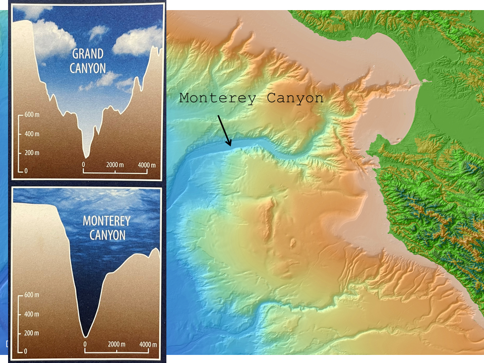
The Monterey Canyon is a submarine canyon off the west coast of California. Together with the Monterey Bay Aquarium Research Institute, Sumner has been involved with several studies of turbidity currents there. In the cross sections at left, the vertical scales are greatly exaggerated but the same in both sections, showing that the Monterey Canyon is similar in scale to the Grand Canyon.
Base map made with GeoMapApp (www.geomapapp.org) / CC BY
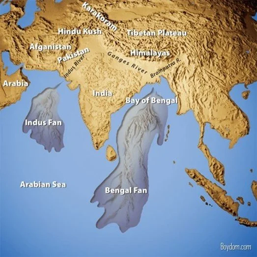
When the submarine canyons reach the deep sea, the sediment they carry can be deposited as submarine fans. These are some of the largest sediment accumulations on Earth. In the podcast, Sumner explains that the Bengal fan is composed of sediments from many millions of years of erosion of the Himalayas.
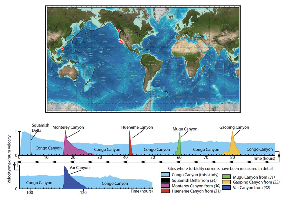
Plot showing relative durations of various turbidity currents at the locations marked with red stars in the map above. The turbidity currents of the Congo Canyon are far more prolonged than any other monitored oceanic turbidity currents. In the podcast, Sumner talks about how some flows reach steady state, maintain constant velocity, and stretch out over time — and she specifically names Congo Canyon as the place where turbidity currents are being monitored for much, much longer durations, i.e., days or even in excess of weeks.
Top: Base map made with GeoMapApp (www.geomapapp.org) / CC BY
Bottom: Azpiroz-Zabala, M. et al. (2017), Science Advances 3: e1700200
Monitoring Equipment
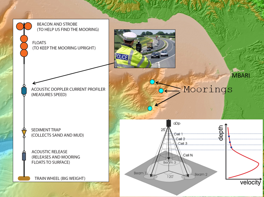
Sumner and her team used acoustic doppler current profilers to measure the velocity profile of the water flow in Monterey Canyon. As indicated in the inset at bottom left, the instrument directs beams of high-frequency sound toward the seafloor and looks for the reflections coming from different depths. The use of three dispersed beacons allows for the flow direction as well as its speed to be measured. We can deduce flow velocities from the shifts in frequency of these reflections. The results, plotted at bottom right, show the velocity profile peaking at up to 8 m/s.
Base map made with GeoMapApp (www.geomapapp.org) / CC BY
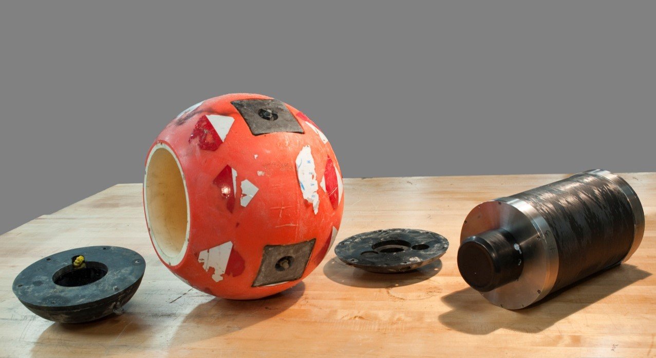
In the podcast, Sumner describes measuring flows on the seafloor with “smart” boulders.
https://www.mbari.org/technology/benthic-event-detectors/
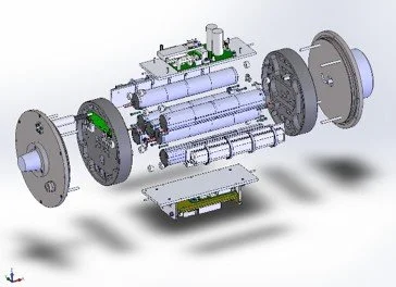
Smart boulders contain accelerometers and depth (pressure) sensors. They also have acoustic modems, enabling them to transmit data, even through over a meter of sediment. The data is picked up by a wave glider (right).
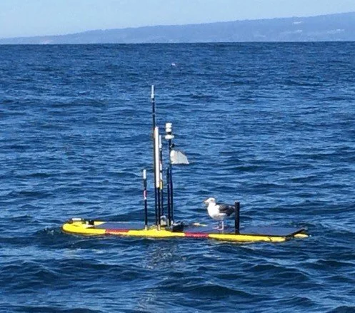
Wave glider, serving as a mobile hotspot for the smart boulders.
https://www.mbari.org/technology/wave-glider-based-communications-hotspot/
Encountering a Turbidity Current in Mendocino Canyon with a Remotely Operated Vehicle
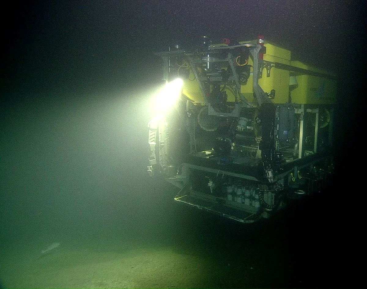
In the podcast, Sumner describes the day when she was aboard a ship operating the remotely operated vehicle (ROV) Doc Ricketts, which is the size of a small car. Equipped with strong lights, it can descend to a depth of 4,000 meters.
https://www.mbari.org/
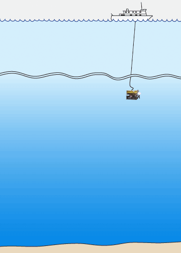
Cartoon (not to scale) of the research vessel Western Flyer at the surface, the ROV Doc Ricketts near the seafloor, and the two types of flow that affected the ROV in Mendocino Canyon.
Kim Fulton-Bennett, (c) 2015 MBARI
Sumner E.J., and C.K. Paull (2014), Swept away by a turbidity current in Mendocino submarine canyon, California. Geophysical Research Letters, 41(21): 7611-7618. doi.org/10.1002/2014GL061863
Video of the ROV’s encounter with a turbidity current in Mendocino Canyon off the west coast of California. It starts with a diagram showing the extent of the turbidity current, with the dense basal layer shaded brown and the dilute upper layer shaded beige. The ROV entered the basal layer, where it lost all visibility, and then ascended to the dilute upper layer.
Courtesy of Monterey Bay Aquarium Research Institute
Submarine Cables and the 2006 Taiwan Event
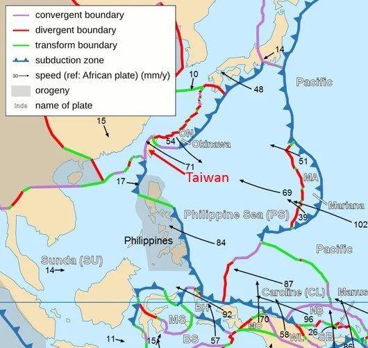
Map showing the complex tectonic setting of Taiwan. The region experiences frequent large earthquakes and high uplift rates.
https://commons.wikimedia.org/wiki/File:Philippine_Sea_plate.JPG
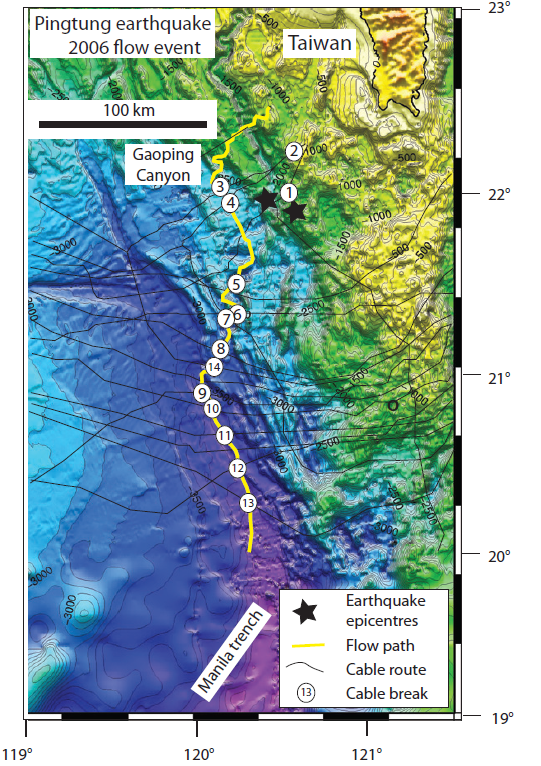
Location of cables south of Taiwan broken by submarine flow triggered by the Pingtung earthquakes in 2006. Two epicentres are shown by black stars. Turbidity currents were triggered by the earthquake, the largest one traveling down the Gaoping canyon, progressively rupturing cables (numbered circles). As Sumner describes in the podcast, the timing of the rupture of the fiber-optic cables provides a way of measuring the movement of the turbidity currents triggered by the earthquake. Speeds of 13 m/s were inferred in the mid-canyon region and 6 m/s at the Manila trench.
Talling, P. T. et al. (2012), Sedimentology 59, 1937
Land-Attached and Land-Detached Canyons
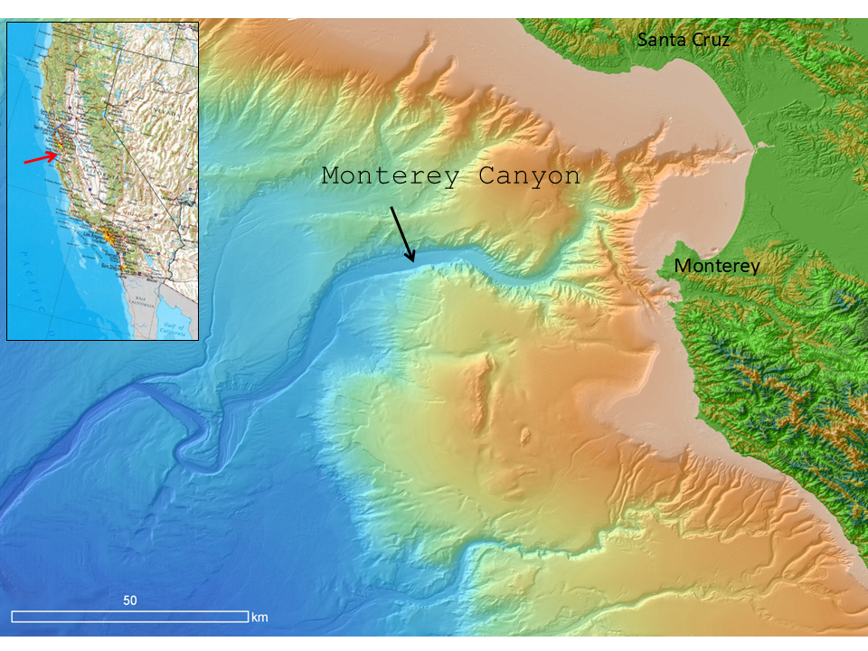
Monterey canyon is an example of a land-attached canyon where the head is practically at the coast. In such canyons, the source of sediment that can feed turbidity currents is long-shore drift and river sediment.
Base map made with GeoMapApp (www.geomapapp.org) / CC BY
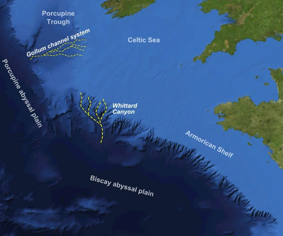
Sumner and her team are currently working on Whittard canyon, a land-detached canyon off the UK’s southwest coast. Such canyons were assumed to be inactive at present-day sea level, but recent work shows they can have fast, destructive turbidity currents.
NASA WorldWind and Mike Norton