
Rob Butler on the Origin of the Alps
Listen to the podcast here, or wherever you get your podcasts.
Scroll down for podcast illustrations.

The Alps are the most intensively studied of all mountain chains, being readily accessed from the geological research centers of Europe. But despite this, there remains considerable uncertainty as to how they formed, especially in the Eocene (about 40 million years ago) when the events that led directly to Alpine mountain-building started. In the podcast, Rob Butler explains how much of this uncertainty stems from our fragmentary knowledge of the locations and structures of sedimentary basins and small continental blocks that lay between Europe and Africa at that time. In his research, he combines detailed studies of the sedimentary rocks flanking the Alps with the large body of structural and petrological knowledge amassed over the past two centuries to try to unravel the sequence of events leading up to the formation of the Alps.
Rob Butler is Professor of Tectonics at the University of Aberdeen, Scotland, UK.
Podcast Illustrations
Images courtesy of Rob Butler unless otherwise noted.
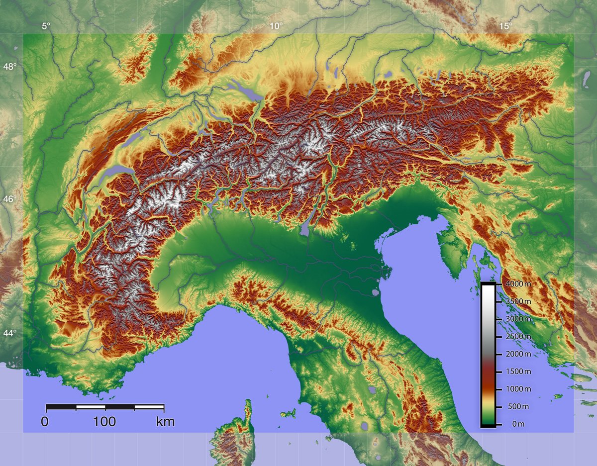
Relief Map of the Alps
The modern Alps form an arc about a thousand km long stretching from the French Riviera on the Mediterranean coast, through southern France, Switzerland, northern Italy, southwestern Germany, Austria, and the Balkans.
Digital elevation data from the Shuttle Radar Topography Mission, NASA
Reconstructions of the Paleogeography at the Southern Margin of Europe

A reconstruction of the paleogeography at the southern margin of Europe for the Santonian age (about 85 million years ago) of the late Cretaceous. Both this reconstruction and the one below show the presence of numerous blocks between Africa and what was to become Europe. The thick purple lines indicate subduction zones with the subducting slab dipping in the direction pointed to by the red triangles. Green/grey bands indicate rift zones. The white labels (e.g., Neotethys) indicate oceans and basins, and the small black legends refer to continental blocks (e.g., Br for Briançonnais), rock formations (e.g., Db for Dent Blanche), rifts (e.g., Sd for the Srednogorie rift-arc), and other geological units.
Stampfli, G.M., et al. (2002), Journal of the Virtual Explorer 8:77

Reconstructions of Alpine and Pyrenees area for the middle Eocene (c. 40 million years ago) and late Oligocene (c. 28 million years ago). As Rob Butler mentions in the podcast, there is an uncertainty of at least 100 km in the positions of the various units. This uncertainty presents a challenge to those seeking to reconstruct the subsequent phases of Alpine evolution.
Stampfli, G.M., et al. (2002), Journal of the Virtual Explorer 8:77

Two different sections through the Jura belt, the top one dating from 1916. Both show how the rocks became detached from the basement of Mesozoic rocks colored grey (top) and orange (bottom). In the outer Alps towards the west (left in the sections), there are few pre-existing faults, so the movement occurs along a weak layer of Triassic evaporites (salt) lying at the top of the basement. This results in thin-skinned or decollement tectonics. Note, in various geological maps, the thrust sheets, e.g., Penninic and Helvetic, are called nappes.
Top section by Butler, R.W.H. after Buxtorf, A., 1916
Present-Day Tectonic Structure and Reconstructions of Past Structure

Tectonic map of Switzerland. The map shows the major thrust sheets (nappes), some of which have been folded and thrust tens of km to the northwest. The upper portion of these sheets has been eroded away, so that, in some cases, parts of the nappes are left as detached islands (klippes), such as those of the Penninic nappes along the northwest margin of the Helvetic nappes.
Baumberger, R., et al. (2019), Ch. 24, 2019 Synopsis of Current Three-Dimensional Geological Mapping and Modelling in Geological Survey Organizations, AER/AGS Special Report 112, p. 249

Panorama and sections of the external Alps, which correspond to an area that was only weakly rifted and faulted before the Alps were formed. The view at top is of the Dauphine area of southeastern France. It corresponds to the central part of the two crustal sections shown below it. The sections run east-west through the Ecrin region of southeastern France. The top section shows the present-day, shortened crust, with the ellipses (squashed circles) representing distributed strain in the crust. In the bottom section, 55 km of crustal shortening has been unwound, while maintaining a constant cross-sectional area.
Contrasting Structures Seen in Outcrop

Looking onto the Jura of France. The geology determines the landforms here, with the ridges corresponding to anticlines.

Large-scale folding of platform carbonates in the Jura mountains.

Metamorphosed limestones that were deformed in a channel of a subduction zone. The rocks show small-scale (meter-scale or less) folding and deformation within the layers.

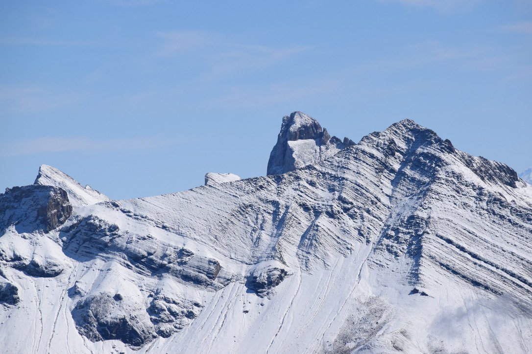
The Mont-Blanc range. Here, the crust was only weakly thinned during Mesozoic rifting (Cretaceous or earlier) on the margins of the Tethys Ocean. The crust then began to shorten and thicken at the beginning of the Miocene as the Alps were forming.

The famous Glarus thrust (red line) in the Tschingelhörner in eastern Switzerland. Permian sandstone (Verrucano) has been thrust over the younger Jurassic limestone. In the podcast, Rob Butler suggests that while such striking features have attracted a great deal of attention during the long history of Alpine geological research, it may be the more elusive distributed deformation throughout the crust that actually accounts for most of the crustal shortening accompanying the formation of the Alps.
Courtesy of IG Tektonik Arena Sardona: Ruedi Homberger
Erosion and Uplift

The vestigial Mer de Glace glacier, Mont Blanc range. In the podcast, Rob Butler makes the counter-intuitive point that as the mountains erode, their peaks get higher. Glacial erosion of deep valleys takes load (mass) off the lithosphere, causing the what remains to rise as a result of isostatic compensation. Thus, if the peaks themselves haven’t eroded, they rise and topographic relief is enhanced, even though average topographic elevation decreases. In the long term, however, the peaks crumble and jagged peaks turn into smooth hills, such as the Appalachians or Urals.
The Annot Sandstone

The Annot Sandstone is a latest Eocene-early Oligocene turbidite in southeast France. The type locality is pictured above. Rob Butler is currently studying these rocks to pin down the timing of uplift at the southern edge of the Western Alps.
The Aiguilles d’Arves display a portion of the Annot Sandstone that was deposited earlier than the type locality units shown at left.
Marnosa Arenacea

The Marnosa Arenacea (above and right) are Miocene turbidites in the northern Apennines. These are the deposits formed by detritus eroded from the ancestral Western Alps. In the podcast, Rob Butler discusses his current interest in these rocks as potential clues to the spatial sequencing of topographic uplift at the start of Alpine mountain-building.

Overview of Alpine Structure
Further Reading
Butler, R.W.H. (2013), Area balancing as a test of models for the deep structure of mountain belts, with specific reference to the Alps. Journal of Structural Geology 52, 2-16.
Butler, R.W.H. (2017), Basement-cover tectonics, structural inheritance and deformation migration in the outer parts of orogenic belts: a view from the western Alps. In: Linkages and Feedbacks in Orogenic Process: A volume in Honor of Robert D Hatcher Jr. (eds Law, R.D., Thigpen, J.R., Merschat, A., Stowell, H. & Bailey C.) Memoir of the Geological Society of America. 213, 55-74.
Butler, R.W.H., Bond, C.E., Cooper, M.A. & Watkins, H.M. (2018), Interpreting structural geometry in fold-thrust belts: why style matters. Journal of Structural Geology 114, 251-273.
The Shear Zone - Rob Butler’s YouTube channel.